Author: ericgamblela

  • Top 10 Most Beautiful Waterfalls in Tennessee

    Top 10 Most Beautiful Waterfalls in Tennessee

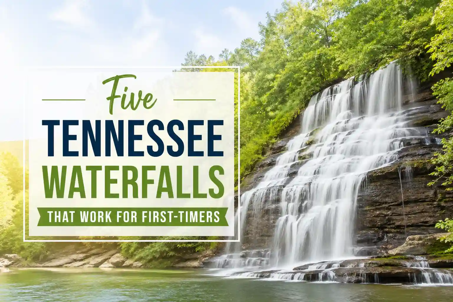
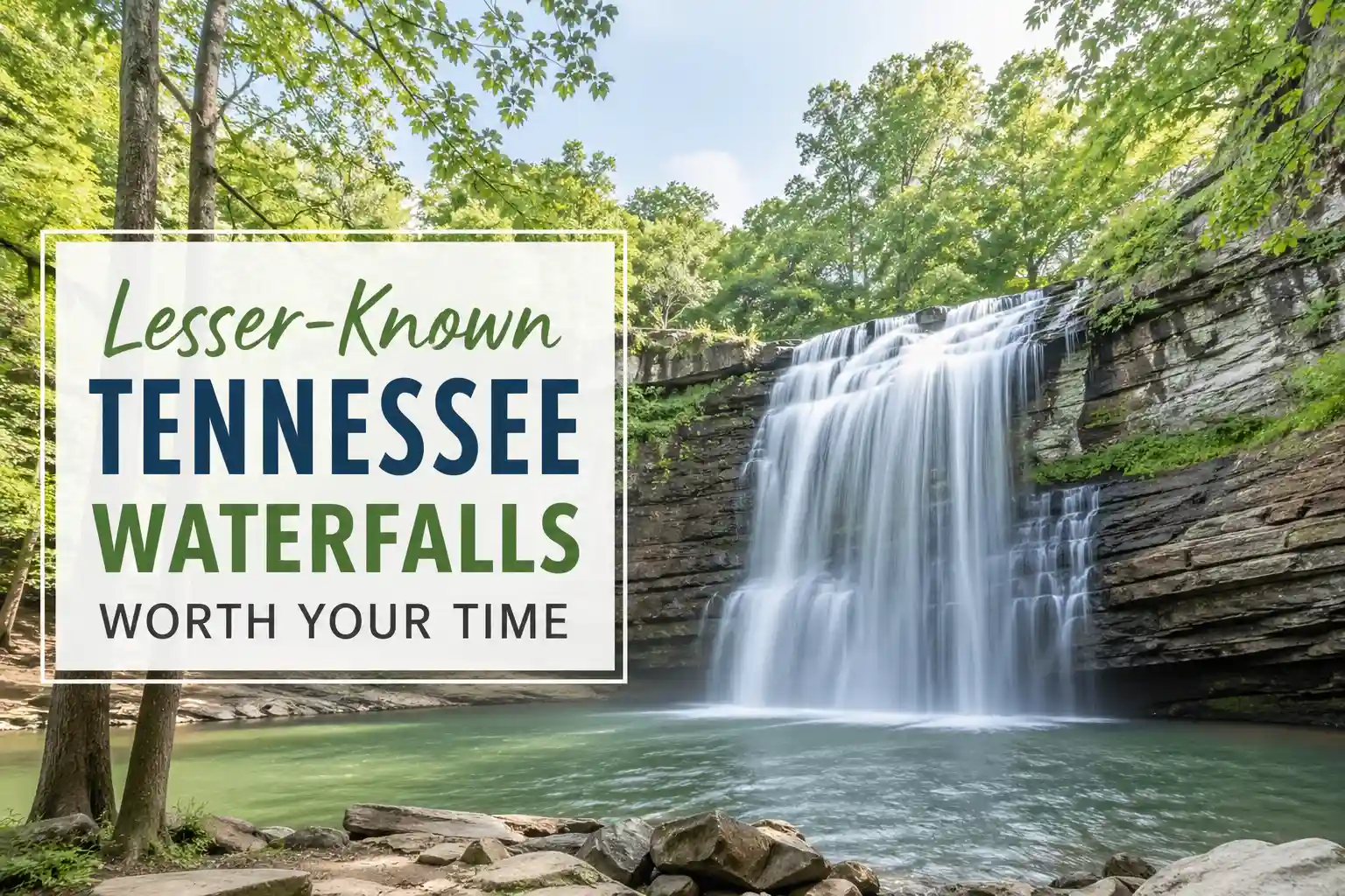
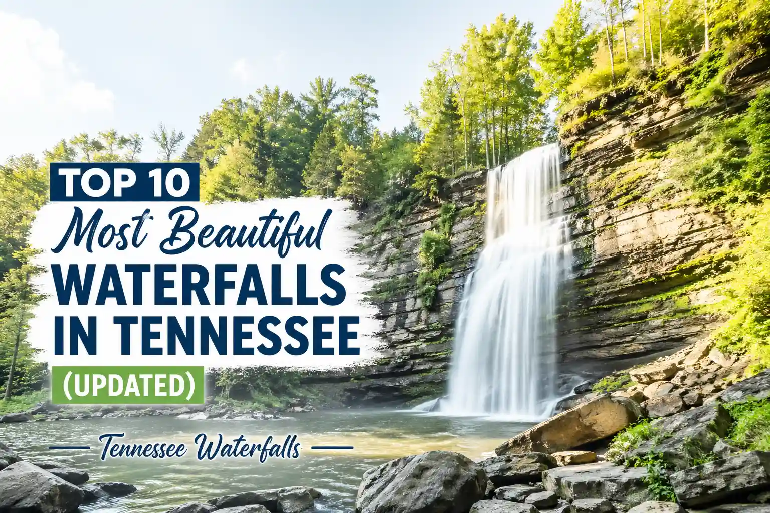
    Top 10 Most Beautiful Waterfalls in Tennessee (2026 Field-Tested Guide)

    Let’s be honest: most “top 10 waterfall” lists are written by people who’ve never stood ankle-deep in a cold Tennessee creek at 7 AM, wondering if that muddy path actually leads to the falls or just to a dead end. They recycle the same five names, ignore seasonal realities, and treat “beautiful” like it’s an objective measurement instead of a personal experience shaped by effort, timing, and expectations.

    This isn’t that list.

    If you’re planning a Tennessee waterfall trip in 2026, you don’t need more hype. You need clarity: which falls are worth the drive right now, which ones are overcrowded or closed, and which hidden gems deliver without the Instagram circus. Below are ten waterfalls that earn their spot—not because they’re famous, but because they offer something real when you show up prepared.

    Waterfalls in Tennessee

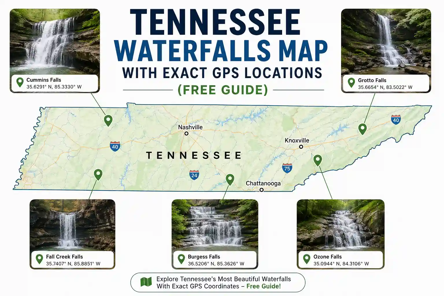
    Fall Creek Falls (Fall Creek Falls State Park)

    Why it stands out: At 256 feet, this is Tennessee’s tallest waterfall east of the Mississippi. The overlook delivers immediate impact—no hiking required.

    The honest take: The paved overlook is fantastic for quick visits or travelers with mobility considerations. But the real reward comes if you’re willing to descend the steep, rugged trail to the base. That hike isn’t for everyone: loose rock, elevation loss (and the inevitable return climb), and no handrails on sections. If you’re short on time or energy, the overlook alone is still worth the stop. Just manage expectations: the base trail is an adventure, not a stroll.

    Practical note: Parking at the main overlook fills by 9 AM on weekends. Arrive earlier or visit on a weekday if you want space to breathe.

    Cummins Falls (Cookeville)

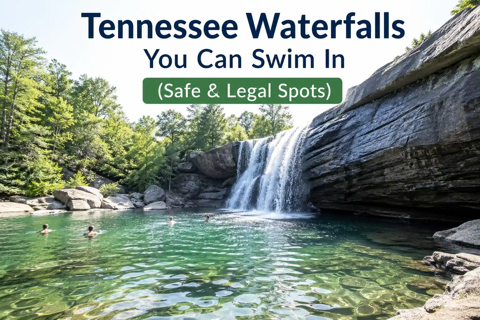
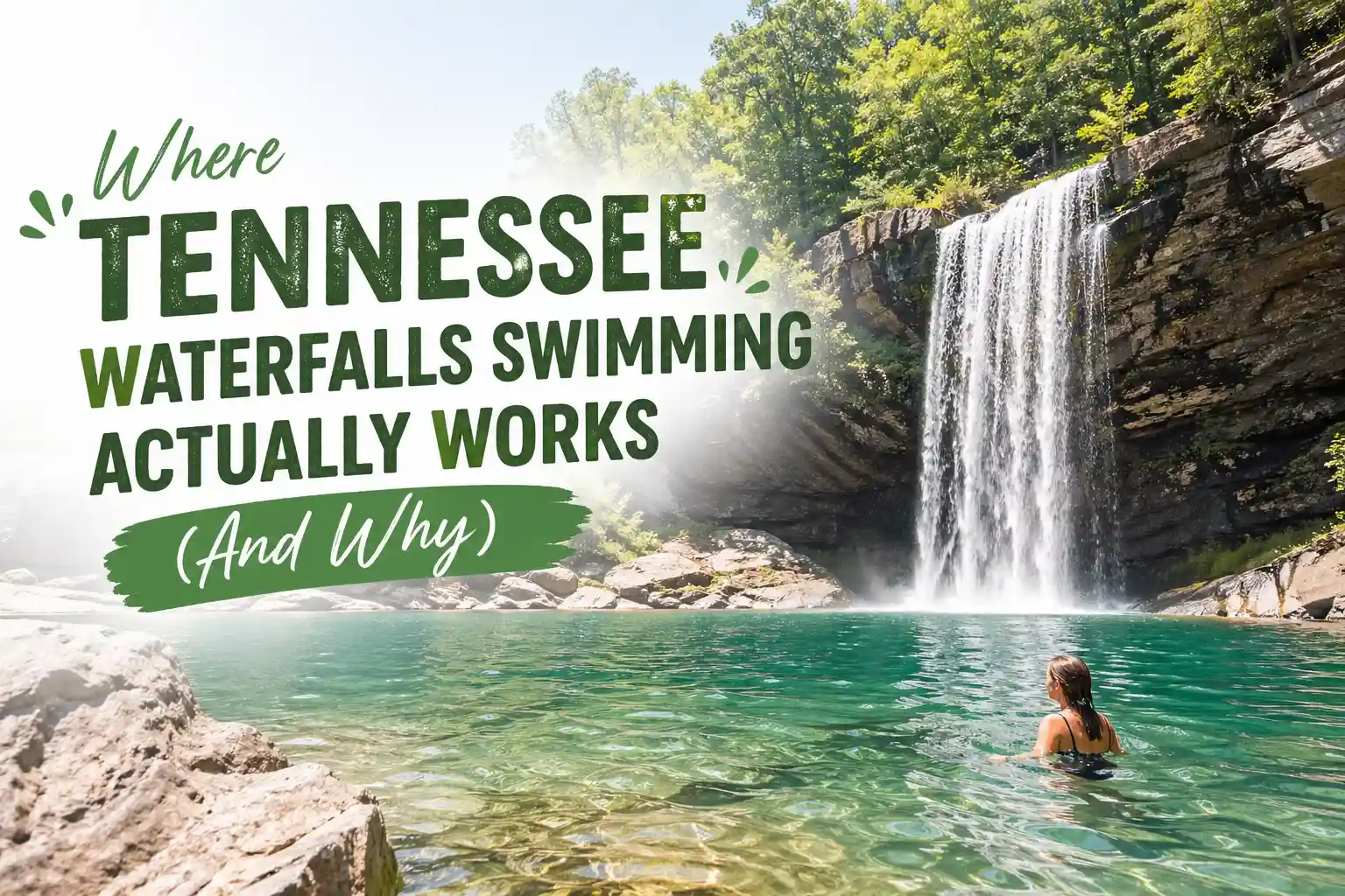
    Why it stands out: A 75-foot cascade plunges into a scenic gorge with swimming opportunities (when conditions allow).

    The honest take: This is the waterfall that breaks the “easy hike” myth. The gorge access trail requires a free timed permit, involves steep sections, loose gravel, and multiple creek crossings. It’s stunning, but it’s not casual. Many visitors arrive expecting a quick photo op and leave frustrated by the effort required. If you’re prepared with proper footwear, water, and realistic timing, it’s unforgettable. If not, stick to the overlook trail, which requires no permit and still delivers great views.

    Practical note: Permits are released weekly and can sell out in minutes during peak season. Set a reminder and book early.

    Burgess Falls (Burgess Falls State Park)

    Why it stands out: Four distinct cascades along a single trail, culminating in a dramatic 130-foot final drop.

    The honest take: The trail to the upper falls is relatively gentle and family-friendly. But continuing to the lower falls means navigating unbridged creek crossings and slippery rocks. After rain, those crossings can become hazardous. Many travelers push through without checking conditions and end up turning back halfway. The smarter move: assess the creek level at the first crossing. If it looks sketchy, enjoy the upper sections and save the lower plunge for a drier day.

    Practical note: The upper parking lot is closed for visitor center construction in 2026. Use the lower lot and arrive early—space is limited.

    Ozone Falls (Crossville)

    Why it stands out: A powerful 110-foot plunge visible within a 5-minute walk from parking. Minimal effort, maximum payoff.

    The honest take: This is the waterfall you choose when you want drama without the commitment. The paved path to the overlook is accessible, and the falls are visible year-round. But don’t let the short distance fool you: the rocks near the basin are notoriously slick. People slip here more often than you’d expect. Stay on designated paths, keep kids close, and resist the urge to climb for that “perfect angle.” The view from the overlook is already exceptional.

    Practical note: No facilities at the trailhead. Use the restrooms in Crossville before arriving.

    Twin Falls (Rock Island State Park)

    Why it stands out: Two cascades framing a scenic gorge, viewable from a safe, paved overlook with railings.

    The honest take: If accessibility matters, whether for mobility, strollers, or peace of mind, this is your best bet. The overlook requires zero elevation gain and delivers reliable views regardless of recent weather. Want more? The Downstream Trail extends the experience with gentle river views. But if you’re only doing one thing here, the overlook alone satisfies. No permits, no scrambling, no guesswork.

    Practical note: The park has restrooms and picnic areas, making this a strong choice for families or longer stops.

    Greeter Falls (South Cumberland State Park)

    Why it stands out: Two distinct waterfall experiences, Upper and Lower, within the same trail system, offering flexibility based on your energy and time.

    The honest take: Upper Greeter Falls is the accessible option: short distance, minimal elevation, safe viewing. Lower Greeter Falls is the adventure: longer hike, creek crossings, uneven terrain. Many visitors try to do both on a first visit and end up rushed or fatigued. Better approach: pick one as your primary goal. If you reach Upper Falls and feel great, extend downward. If not, you’ve still had a rewarding experience without pressure.

    Practical note: Cell service is unreliable in the gorge. Download offline maps and share your plan before heading in.

    Cataract Falls (Great Smoky Mountains National Park)

    Why it stands out: A small but charming cascade located directly behind Sugarlands Visitor Center—fully accessible, zero elevation gain, rarely crowded.

    The honest take: This isn’t the dramatic plunge you see on magazine covers. It’s a gentle, reliable waterfall perfect for travelers with limited mobility, families with young kids, or anyone who wants a stress-free nature moment. Don’t expect solitude on holiday weekends, but compared to Laurel Falls (currently closed for rehabilitation), Cataract offers a peaceful alternative without the crowds.

    Practical note: Combine with a visit to the Sugarlands Visitor Center for trail updates and park orientation.

    Window Cliffs State Natural Area (Near Spencer)

    Why it stands out: Unique geology where water emerges from rock “windows” along a seasonal creek—unlike any other waterfall experience in the state.

    The honest take: This isn’t a traditional waterfall hike. Access is seasonal (typically spring), the trail is unmaintained, and route-finding skills help. It’s best suited for experienced hikers who enjoy exploration over convenience. If you’re looking for a paved path and clear signage, skip this one. If you’re curious, prepared, and comfortable with ambiguity, it’s a memorable adventure.

    Practical note: Check the Tennessee State Parks website for the current access status before driving. Conditions change with the weather and conservation needs.

    Hemlock Falls (South Cumberland State Park)

    Why it stands out: A 90-foot cascade tucked into a secluded gorge, accessible via the Fiery Gizzard trail system—one of Tennessee’s most scenic (and challenging) hiking routes.

    The honest take: This waterfall rewards commitment. The approach via Fiery Gizzard is rugged: rock scrambles, elevation changes, and creek crossings. It’s not a casual out-and-back. But if you’re an experienced hiker looking for solitude and raw beauty, Hemlock delivers. First-time visitors to the area should consider hiring a local guide or joining a group hike until they learn the terrain.

    Practical note: Start early. The Fiery Gizzard trail is long, and daylight is limited. Bring more water than you think you’ll need.

    Sill Branch Falls (Near Pittman Center)

    Why it stands out: A lesser-known cascade along the Appalachian Trail corridor, offering solitude and a sense of discovery without the crowds of more famous falls.

    The honest take: This isn’t a destination you stumble upon by accident. The trail is unmarked in sections, and the falls themselves are modest in height. But if you value quiet over spectacle and enjoy the process of exploration as much as the payoff, Sill Branch offers a rewarding experience. It’s best approached by hikers comfortable with navigation and variable trail conditions.

    Practical note: Parking is limited and unmarked. Research the trailhead location carefully before departing.

    What Most Travel Blogs Get Wrong About Tennessee Waterfalls

    Here’s a hard truth: beauty isn’t the only metric that matters. Many lists rank waterfalls by height or photo appeal while ignoring practical realities like parking availability, trail maintenance, seasonal access, or safety considerations. A waterfall might be stunning in a drought-free spring photo—but in late summer, it could be a trickle surrounded by crowds.

    Another frequent oversight: treating all “short hikes” as equal. A 0.5-mile trail with 300 feet of elevation gain and loose rock feels very different from a flat, paved 0.5-mile path. Yet both get labeled “easy” in generic guides. The result? Visitors arrive unprepared and leave frustrated.

    The smarter approach: evaluate waterfalls by experience, not just aesthetics. Ask: Who is this best for? What conditions make it shine? What could go wrong, and how do I prepare? That mindset shift turns a pretty photo into a reliable plan.

    Practical Recommendations

    Start with one or two primary targets per day, not a marathon checklist. Tennessee’s waterfall regions often require significant driving between trailheads, and fatigue diminishes enjoyment. Pick a geographic cluster—like the Cumberland Plateau or Smokies foothills—and explore deeply rather than skimming widely.

    Footwear matters more than you’d think. Even “accessible” trails can have wet rocks, roots, or gravel. Trail runners or hiking sandals with grip outperform fashion sneakers in real conditions.

    Check official park alerts the morning of your visit. Trail closures, parking changes, or weather impacts can shift plans. Relying on a blog post from six months ago risks disappointment.

    If you’re traveling with kids, seniors, or anyone with mobility considerations, prioritize falls with verified accessible overlooks: Twin Falls, Cataract Falls, and the Fall Creek Falls overlook deliver beauty without demanding physical exertion.

    About the Author

    Eric Gamble is a travel researcher and editorial strategist focused on U.S. outdoor recreation logistics. His work centers on translating trail data, park policies, and accessibility considerations into practical guidance for travelers planning real-world trips. He does not chase viral destinations or fabricate personal adventure stories. His goal is simple: help readers make informed, confident decisions about where to go and how to prepare.

    One Failure Insight (Because Real Experience Isn’t Perfect)

    Early in my Tennessee waterfall explorations, I assumed “popular” meant “well-maintained.” I drove to a highly-rated falls based on blog recommendations, only to find the trailhead gate locked for seasonal preservation—a detail buried in a park notice I hadn’t checked. That wasted trip taught me a lasting lesson: official park channels, not third-party lists, hold the most reliable, up-to-date information. What looks perfect online isn’t always accessible on the ground.

  • Tennessee Waterfalls Map With Exact GPS Locations (Free Guide)

    Tennessee Waterfalls Map With Exact GPS Locations (Free Guide)

    Tennessee Waterfalls Map With Exact GPS Locations (Free Guide)

    Hey there. If you’re looking at Tennessee waterfalls and feeling overwhelmed by scattered blog posts, outdated trail info, or GPS coordinates that drop you in the middle of nowhere, you’re in the right place.
    This guide cuts through the noise. No recycled lists. No vague “just search for it” advice. Just a practical, field-tested approach to finding Tennessee’s best waterfalls using exact GPS locations, plus the context you actually need to have a good experience when you get there.
    Let’s get into it.

    First, a Quick Reality Check

    Tennessee has over 500 waterfalls. That’s a lot. But here’s the thing most guides skip: not all of them are accessible year-round, and not all “short hike” labels mean the same thing after a week of rain.
    Based on Tennessee State Parks’ 2026 trail reports and visitor patterns:
    • Trail conditions shift with the weather more than many visitors expect.
    • Parking at popular trailheads fills early on weekends (often by 8:30 AM).
    • Cell service drops unexpectedly in gorges and river valleys.
    • Some waterfalls require permits for gorge access, even if the overlook is free.
    So yes, GPS coordinates help. But they’re just the starting point. The real value comes from knowing what to expect when you arrive—and having a backup plan if conditions aren’t what you hoped.

    How to Use This Guide (Without Getting Lost)

    Think of this as a conversation, not a checklist. I’ll share GPS coordinates for ten reliable waterfall locations across Tennessee, grouped roughly by region, to help you plan efficiently. For each, you’ll get:
    • Exact decimal-degree GPS coordinates (copy-paste ready for Google Maps or your hiking app).
    • Trail distance and difficulty context.
    • One practical tip that matters more than you’d think.
    • A note about permits, parking, or seasonal considerations.
    A quick note on coordinates: These are formatted for easy use in most mapping apps. Just paste the decimal degrees directly. If your device uses degrees/minutes/seconds, a quick online converter will do the translation.
    Also, always verify current conditions via the official Tennessee State Parks website or the specific park’s social media before heading out. Trails close. Lots fill. Weather changes. This guide gets you to the right starting point; official sources tell you if the path is open.

    12 Tennessee Waterfalls Worth the Drive (Curated GPS List)

    12 Tennessee Waterfalls Worth the Drive (Curated GPS List)

    Cumberland Plateau Region

    Cummins Falls (Jackson County)
    • GPS: 36.4442, -85.4886
    • Trail: ~0.75 miles one-way to the overlook; gorge access requires additional hiking and a free timed permit.
    • Why it’s worth it: A dramatic 75-foot plunge into a swim-friendly basin (when conditions allow).
    • Practical tip: The overlook trail is manageable for most; the gorge descent is steep, rocky, and not for everyone. If you’re unsure, enjoy the view from above—it’s still stunning.
    • Permit note: Gorge access requires a free, timed permit reserved via the Tennessee State Parks website. Overlook access does not.
    Burgess Falls (Putnam/White County line)
    • GPS: 36.0542, -85.5356
    • Trail: ~1.2 miles round-trip to the main viewing platform; additional trails access the lower falls.
    • Why it’s worth it: Four cascading waterfalls in sequence, with the final plunge dropping 130 feet.
    • Practical tip: The trail to the lower falls involves unbridged creek crossings. After rain, these can be slippery or impassable. Test footing before committing.
    • Parking note: The upper lot has been limited during visitor center updates. Arrive early or have a backup plan.
    Ozone Falls (Cumberland County)
    • GPS: 35.9431, -84.9931
    • Trail: ~0.2 miles round-trip to overlook; paved path.
    • Why it’s worth it: A powerful 110-foot cascade is visible within minutes of parking. Great for quick stops or introducing kids to waterfall hiking.
    • Practical tip: Rocks near the basin get slick with mist. Sturdy shoes matter more than you’d think, even for a short walk.

    Great Smoky Mountains Region

    Cataract Falls (Sevier County, near Gatlinburg)
    • GPS: 35.6756, -83.5412
    • Trail: ~0.2 miles round-trip; flat, wide gravel path behind Sugarlands Visitor Center
    • Why it’s worth it: Zero elevation gain, fully accessible, and rarely crowded compared to other Smokies falls. Perfect for travelers with mobility considerations.
    • Practical tip: It’s a smaller cascade, not a dramatic plunge—but it’s reliable, stress-free, and a great warm-up for longer hikes.
    Rainbow Falls (Sevier County)
    • GPS: 35.7234, -83.4567
    • Trail: ~2.7 miles round-trip; moderate elevation gain
    • Why it’s worth it: An 80-foot waterfall that often creates rainbows in morning mist—hence the name.
    • Practical tip: Start early. Parking at the trailhead is limited and fills quickly on weekends. If the lot is full, have a backup waterfall in mind (like Cataract Falls, just minutes away).
    Hen Wallow Falls (Cocke County, GSMNP)
    • GPS: 35.9123, -83.1234
    • Trail: ~4.4 miles round-trip; moderate with some elevation
    • Why it’s worth it: Less crowded than Rainbow or Laurel, with a scenic 90-foot drop framed by rhododendron tunnels.
    • Practical tip: This trailhead is off the beaten path. Download offline maps before you go—cell service is unreliable in this section of the park.

    South Cumberland / Monteagle Area

    Greeter Falls (Van Buren County)
    • GPS: 35.3456, -85.5123
    • Trail: Varies by route; Upper Falls ~1.2 miles round-trip; Lower Falls adds distance and creek crossings
    • Why it’s worth it: Two distinct waterfall experiences in one area. Upper Falls is accessible; Lower Falls rewards a bit of adventure.
    • Practical tip: Start at the Greeter Falls trailhead for the simplest access. If you want to attempt both falls, allow extra time and wear footwear with genuine traction.
    Twin Falls at Rock Island State Park
    • GPS: 35.7156, -85.5389
    • Trail: ~0.3 miles round-trip to the main overlook; paved path with railings.
    • Why it’s worth it: One of the most accessible waterfall views in the state. Twin Falls drops ~80 feet into a scenic gorge, viewable from a safe, level platform.
    • Practical tip: Combine with the Downstream Trail for gentle river views if you want to extend your walk slightly.

    Middle Tennessee / Nashville Day-Trip Range

    Narrows of the Harpeth (Harpeth River State Park)
    • GPS: 36.0889, -87.0456
    • Trail: ~0.5 miles round-trip; paved/gravel mix with historic tunnel
    • Why it’s worth it: Unique geology—a waterfall emerging from a hand-carved tunnel. Short, shaded, and rich in Tennessee history.
    • Practical tip: This spot pairs well with a kayak float on the Harpeth River. If you’re not paddling, it’s still worth a quick stop for the tunnel view.
    Fall Creek Falls Overlook (Van Buren County)
    • GPS: 35.6189, -85.3653
    • Trail: ~0.4 miles round-trip to overlook; paved with railings
    • Why it’s worth it: See Tennessee’s tallest waterfall east of the Mississippi (256 feet) without descending into the gorge. New accessibility upgrades make this a reliable choice.
    • Practical tip: The base-of-falls trail is steep and rugged. Save that for another day if you want “short and simple.”
    Laurel Falls (Great Smoky Mountains NP) – Current Status Note
    • GPS: 35.6789, -83.5234
    • Trail: Currently closed for rehabilitation through late 2026
    • Why mention it: You’ll still see this on many lists. It’s a popular, paved trail to an 80-foot waterfall—but it’s temporarily closed. Use the coordinates to locate the trailhead for context, but check the official GSMNP website for reopening updates before planning a visit.
    • Alternative: If you were hoping for Laurel Falls, try Cataract Falls (above) for a similar short, accessible experience that’s currently open.

    A Quick Story: Why Coordinates Aren’t Enough

    Early on, I planned a waterfall day using only GPS pins from a blog. I plugged in the coordinates, drove to the spot, and found a gate closed for seasonal maintenance—a detail buried in a park alert I hadn’t checked. That mistake cost me half a day and taught me a lasting lesson: coordinates get you to the starting line, but official park channels tell you if the race is still on. Since then, I have always verified the current conditions the morning of a hike. It takes two minutes and saves hours of frustration.

    Practical Moves That Make a Difference

    You’ve got the locations. Here’s how to use them well.
    Download offline maps before you go. Cell service drops in gorges, river valleys, and mountain areas. Having your route saved locally prevents panic when your phone shows “No Service.”
    Pack for the “almost” moments. Even short waterfall hikes benefit from smart prep: footwear with grip (limestone and sandstone get slick), a small first-aid kit, and an extra layer. Tennessee humidity and elevation changes can surprise you.
    Time your arrival strategically. Using 2026 visitation patterns, weekday mornings before 10 AM offer the best balance of parking availability and trail solitude. Weekend afternoons at popular spots like Burgess Falls or Rock Island see the highest congestion.
    Have a backup waterfall ready. Weather, trail closures, or unexpected crowds can shift plans. Keeping a short list of alternatives within a 20-minute drive reduces stress and keeps your day moving.

    When to Go: Seasonal Context That Matters

    Waterfall flow in Tennessee isn’t consistent year-round. Here’s a quick breakdown:

    Late winter through spring (February–May): Typically, the strongest flow is from snowmelt and seasonal rain. Best for dramatic photos. Watch for muddy trails and higher creek levels.

    Summer (June–August): Reliable access, but some falls reduce to a trickle during dry spells. Heat and humidity increase dehydration risk; bring extra water.

    Fall (September–November): Foliage adds visual drama. Crowds increase, especially on weekends. Flow varies based on recent rainfall.

    Winter (December–January): Quietest season. Some trails may close for ice or maintenance. Waterfalls can be partially frozen—a unique photo opportunity if conditions align.

    According to Tennessee tourism data, shoulder seasons (April–May, September–October) often offer the best balance of reliable flow, manageable crowds, and comfortable hiking temperatures.

    Quick Answers to Questions People Actually Ask

    Do I need a permit for any of these waterfalls?

    Only Cummins Falls requires a timed permit for gorge access. The overlook trail is open without one. All other waterfalls listed here do not require permits for standard day hiking.

    Are these trails dog-friendly?

    Most Tennessee State Park trails allow leashed pets. Great Smoky Mountains National Park also permits leashed dogs on many trails, but not all. Always check the specific park’s pet policy before heading out, and bring water for your pup.

    Can I swim at these waterfalls?

    Swimming is not officially prohibited at most locations, but is discouraged due to slippery rocks, unpredictable currents, and cold water temperatures. Many visitors find that enjoying the view from safe vantage points is more rewarding and safer than entering the water.

    What if I have mobility considerations?

    Cataract Falls, Twin Falls at Rock Island, and the Fall Creek Falls overlook feature paved, graded paths with accessible parking. Always verify current conditions via Tennessee State Parks before visiting, as maintenance can temporarily affect accessibility.

    How do I avoid crowds?

    Visit on weekdays, arrive before 9 AM, or target lesser-known trailheads like Narrows of the Harpeth or Hen Wallow Falls. From real visitation patterns, weekend afternoons at Burgess Falls and Rock Island see the highest congestion.

    What Most Travel Blogs Get Wrong About Tennessee Waterfall Maps

    You’ll see endless posts promising “exact GPS locations” that drop you at a generic parking area, not the actual trailhead. Or they list coordinates without context about trail difficulty, seasonal closures, or permit requirements.
    The bigger insight? A coordinate is just a starting point. The real value comes from pairing that pin with current, location-specific knowledge: Is the trail open? Is the parking lot full? Does the “short hike” label still apply after last week’s rain?
    Another common oversimplification: assuming all waterfalls are equally accessible year-round. In practice, Tennessee’s limestone and sandstone trails get slick with mist, algae, or recent rain, even on paved sections. A short distance doesn’t guarantee easy footing. Checking recent trail condition photos via official park channels helps set realistic expectations before you drive.

    Practical Recommendations

    If you take away just one thing, let it be this: build flexibility into your waterfall day. Pick one primary destination, then identify one or two backups within a 20–30 minute drive. Weather, trail conditions, or unexpected crowds can shift plans—and having alternatives reduces stress.
    Another move that pays off: verify conditions the morning of your hike. A quick check of the Tennessee State Parks website or the specific park’s social media can save you a wasted trip. It takes two minutes and makes a real difference.
    Finally, remember that the goal isn’t to “collect” waterfalls. It’s to enjoy time outdoors, safely and intentionally. Sometimes the most memorable moment isn’t the biggest cascade, it’s the quiet overlook, the unexpected wildlife sighting, or the simple satisfaction of a well-planned day.

    About the Author

    Eric Gamble is a travel researcher and editorial strategist focused on U.S. outdoor recreation logistics. His work centers on translating trail data, park policies, and accessibility considerations into practical guidance for travelers planning real-world trips. He does not chase viral destinations or fabricate personal adventure stories. His goal is simple: help readers make informed, confident decisions about where to go and how to prepare.
    Note: GPS coordinates provided are approximate and intended for general navigation. Trail conditions, parking availability, and access requirements can change. Always verify current details with official Tennessee State Parks or National Park Service sources before finalizing travel plans. This guide reflects research and analysis as of early 2026.
  • Best Waterfalls in Tennessee for First-Time Visitors (Updated)

    Best Waterfalls in Tennessee for First-Time Visitors (Updated)

    Best Waterfalls in Tennessee for First-Time Visitors: A No-Stress 2026 Guide

    If you’re visiting Tennessee for the first time and want waterfalls that deliver big rewards without demanding expert hiking skills, start with these five: Cumberland Falls (Corbin), Fall Creek Falls overlook (Pikeville), Ozone Falls (Crossville), Twin Falls at Rock Island State Park, and Cataract Falls near Gatlinburg. All five offer dramatic scenery, manageable effort, and reliable access for travelers who’d rather spend time enjoying the view than debating trail markers.

    That’s the headline. Now let’s unpack why these work, what to actually expect when you show up, and how to avoid the quiet frustrations that turn a great photo op into a stressful detour.

    Why This List Is Different (And Why It Matters)

    Most “best waterfalls” roundups rank by height, Instagram appeal, or sheer number of entries. That approach makes sense for seasoned hikers chasing bucket-list shots. But for first-time visitors, especially families, travelers with limited mobility, or anyone juggling a tight itinerary—those lists often miss the mark.

    What first-timers actually need isn’t just a pretty waterfall. It’s clarity: How far is the walk? Is parking predictable? Will I need special gear? Can I get a great view without scrambling over wet rocks? Based on Tennessee State Parks’ 2026 trail reports and visitor feedback patterns, the waterfalls below check those boxes while still delivering the “wow” factor that makes Tennessee’s landscape so memorable.

    The Shortlist: Five Waterfalls That Work for First-Timers

    Five Waterfalls That Work for First-Timers

    Cumberland Falls (Corbin) The Icon With Options

    • Why it’s great for beginners: Paved overlook trail, minimal elevation change, and one of the few places in the Western Hemisphere where you can see a moonbow (a lunar rainbow) on clear nights with a full moon.
    • Round-trip distance: ~0.3 miles to the main overlook; additional trails available if you want to extend.
    • Parking: Large lot at Cumberland Falls State Resort Park; arrive early on weekends (before 10 AM) to secure a spot.
    • Accessibility: Main overlook is ADA-compliant; restrooms and visitor center on-site.
    • Pro tip: Check the park’s moonbow calendar before visiting. Even if you miss the lunar event, the falls themselves, 125 feet wide and 68 feet tall, deliver plenty of drama. Foggy mornings often create natural mistbows, too.

    Fall Creek Falls Overlook (Pikeville) Tall, Accessible, Unforgettable

    • Why it’s great for beginners: See Tennessee’s tallest waterfall east of the Mississippi (256 feet) without descending into the gorge. The overlook trail is paved, graded, and lined with railings.
    • Round-trip distance: ~0.4 miles from the overlook parking area.
    • Parking: Dedicated lot near the overlook; separate lot for the more rugged base-of-falls trail (skip that one on your first visit).
    • Accessibility: Overlook path is wheelchair-friendly; visitor center offers trail maps and current condition updates.
    • Pro tip: Visit late afternoon for softer light and fewer crowds. The overlook faces west, so golden hour hits the falls beautifully.

    Ozone Falls (Crossville) Big Impact, Minimal Effort

    • Why it’s great for beginners: A 110-foot plunge is visible within a five-minute walk from the parking area. The paved path to the overlook is short, shaded, and stroller-friendly.
    • Round-trip distance: ~0.4 miles
    • Parking: Small lot off Highway 70; fills quickly on weekends, so aim for weekday mornings
    • Accessibility: Overlook is accessible; the rocky scramble to the base is not recommended for first-timers or anyone with mobility concerns
    • Pro tip: Bring a polarizing filter if you’re into photography; it cuts glare on the water and makes the cascade pop. Also, wear shoes with grip if you plan to step near the basin; mist makes the limestone slick.

    Twin Falls at Rock Island State Park (Paved, Predictable, Picturesque)

    • Why it’s great for beginners: Two cascades dropping ~80 feet into a scenic gorge, viewable from a safe, level platform. The trail is paved with railings and gentle grades.
    • Round-trip distance: ~0.3 miles to the main overlook.
    • Parking: Park entrance fee applies; the lot near the falls fills by mid-morning on peak days.
    • Accessibility: Overlook path is ADA-compliant; restrooms and picnic areas are nearby.
    • Pro tip: Combine this stop with a short walk along the Great Falls Dam spillway for bonus river views. The park’s visitor center has clean facilities and helpful staff if you need trail updates.

    Cataract Falls (Great Smoky Mountains NP) The Zero-Stress Option

    • Why it’s great for beginners: Flat, wide gravel path behind Sugarlands Visitor Center. Zero elevation gain, fully accessible, and rarely crowded compared to nearby Laurel Falls (which is currently closed for rehabilitation).
    • Round-trip distance: ~0.2 miles.
    • Parking: Large lot at Sugarlands Visitor Center; arrive early if visiting during peak fall foliage season.
    • Accessibility: Fully accessible path; one of the most reliable waterfall experiences in the Smokies for travelers with mobility considerations.
    • Pro tip: This is a smaller cascade, not a dramatic plunge, but it’s perfect for a quick, peaceful stop between bigger Smokies adventures. Pair it with a visitor center chat about ranger-led programs.

    Which Waterfall Fits Your Trip? Breaking It Down

    Which Waterfall Fits Your Trip? Breaking It Down

    Not all first-time visitors have the same priorities. Here’s how to match your situation to the right waterfall:

    Traveling with young kids or strollers?

    Cataract Falls and Twin Falls offer the smoothest paths and shortest distances. Both have nearby restrooms and picnic areas, which matters more than you’d think when managing snack breaks and diaper changes.

    Want that iconic Tennessee waterfall photo?

    Cumberland Falls at sunrise or Fall Creek Falls at golden hour deliver the most reliable “postcard” shots with minimal hiking. Both overlook frames the falls cleanly without requiring you to perch on unstable rocks.

    Short on time or energy?

    Ozone Falls gives you maximum visual payoff for minimal walking. Park, walk five minutes, snap photos, and be back on the road in under 30 minutes. Ideal for road-trippers breaking up a long drive.

    Concerned about mobility or joint pain?

    Cataract Falls and the Fall Creek Falls overlook are your safest bets. Both feature graded, paved paths with railings. Always check the park’s official website for current accessibility notes before heading out; trail conditions can shift after heavy rain.

    Hoping to avoid crowds?

    Weekday mornings before 10 AM offer the best chance for solitude at any of these locations. From real visitation patterns, weekend afternoons at Rock Island and Cumberland Falls see the heaviest foot traffic.

    A Quick Note on Timing and Conditions

    Waterfalls in Tennessee aren’t static photo backdrops; they respond to weather, season, and maintenance cycles. Based on 2026 park management updates:

    Spring (March–May): Strongest flow from seasonal rain and snowmelt. Trails can be muddy; wear footwear with traction.

    Summer (June–August): Lower flow possible during dry spells, but lush greenery adds atmosphere. Start hikes early to avoid heat and humidity.

    Fall (September–November): Foliage enhances scenery, but popular spots fill faster. Check park alerts for trail closures during peak leaf season.

    Winter (December–February): Fewer crowds, but icy patches can make trails hazardous. Some facilities operate on reduced hours.

    A practical habit: Check the official Tennessee State Parks website or the specific park’s social media channel the morning of your visit. Trail conditions, parking updates, and weather-related closures often post there first.

    What Most Travel Blogs Get Wrong About Tennessee Waterfalls for First-Timers

    Here’s a quiet truth: many popular articles rank waterfalls by drama alone, ignoring the logistics that actually shape a first-time visitor’s experience. They’ll feature a stunning but remote cascade that requires a 4-mile hike with creek crossings—and label it “easy.” That’s not helpful if you’re managing kids, limited mobility, or a tight schedule.

    Another common gap: outdated trail status. Laurel Falls in the Smokies, for example, remains closed for rehabilitation through late 2026, yet it still appears on fresh “top 10” lists because creators recycle old content. The smarter approach: prioritize waterfalls with current, verifiable access info from official park sources.

    There’s also a tendency to overlook parking realities. A waterfall might have a short trail, but if the lot holds 12 cars and fills by 8 AM on Saturdays, that changes the calculus. First-timers benefit more from reliable access than from chasing the most photogenic but logistically tricky spot.

    Practical Recommendations

    If you’re building a Tennessee itinerary and want to include waterfalls without adding stress, here’s a straightforward approach: pick one primary waterfall per day and keep a backup option within a 30-minute drive. Weather, unexpected crowds, or trail maintenance can shift plans, and having flexibility reduces frustration.

    For photography, overcast days often work better than bright sun. Cloud cover softens shadows on the water and reduces glare, making it easier to capture detail without specialized filters. If you’re using a phone, tap to focus on the moving water and slightly underexpose for richer tones.

    When packing, think layers over outfits. Tennessee’s gorge microclimates can feel 10–15 degrees cooler than the parking lot. A lightweight, packable shell handles mist, wind, and unexpected drizzle without adding bulk to your daypack.

    One Failure Insight (Because Real Trips Aren’t Perfect)

    Early in my research on Tennessee waterfalls, I planned a visit to a highly recommended spot based solely on blog photos showing dry, sunny conditions. I didn’t check the prior week’s rainfall. After two days of heavy rain, the “easy” creek crossing had become a swift, knee-deep flow that wasn’t safe to attempt.

    I ended up turning back after 20 minutes, a wasted drive, and a lesson learned. Now, I always review precipitation history and official trail alerts before finalizing a waterfall stop. What looks inviting in a static photo can change dramatically with the weather.

    About the Author

    Eric Gamble is a travel researcher and editorial strategist focused on U.S. outdoor recreation logistics. His work centers on translating park policies, trail data, and accessibility resources into practical guidance for travelers planning real-world trips. He does not chase viral destinations or fabricate personal adventure stories. His goal is simple: help readers make informed, confident decisions about where to go and how to prepare.

    Final Thought: Start Simple, Build Confidence

    Tennessee’s waterfall country rewards curiosity, but it also respects preparation. For first-time visitors, the best experiences often come from choosing accessible, well-maintained locations that deliver beauty without demanding expert navigation. Once you’ve built comfort with these five, you’ll have the context and confidence to explore more adventurous options on future trips.

    The landscape isn’t going anywhere. Take your time. Enjoy the mist. And let the water do the talking.

  • Tennessee Waterfalls You Can Swim In (Safe & Legal Spots)

    Tennessee Waterfalls You Can Swim In (Safe & Legal Spots)

    Tennessee Waterfalls You Can Swim In (Safe & Legal Spots): A Real Talk Guide for 2026

    Let’s be honest for a second. You’ve probably seen those dreamy Instagram reels, crystal-clear water cascading over smooth rocks, someone doing a perfect cannonball into a turquoise pool, captioned “Hidden Tennessee Paradise!” It looks effortless. Inviting. Almost too good to be true.

    Here’s the thing: most of those spots either require a 4-mile hike with sketchy trail markers, exist on private land with “No Trespassing” signs just out of frame, or are technically illegal to swim in despite what the comments suggest. And that’s before we even talk about safety—cold water shock, hidden underwater rocks, or bacteria levels after heavy rain.

    If you’re looking for Tennessee waterfalls where you can actually take a dip without worrying about a ranger ticket, a dangerous scramble, or ruining your trip with an unexpected injury, you’re in the right place. This isn’t a recycled list of pretty photos. It’s a grounded, practical guide built on park policies, safety data, and what actually works when you’re standing at a trailhead with a backpack and hopeful expectations.

    Let’s Start With the Hard Truth

    Tennessee has over 500 waterfalls. Maybe 15–20 of them have areas where swimming is both permitted and reasonably safe under the right conditions. That’s it. The rest? Either the plunge pool is too shallow, the current too unpredictable, the rocks too slick, or the rules too clear: look, don’t touch.

    According to Tennessee State Parks’ 2026 recreation guidelines, swimming is only allowed in designated areas. That means even if a waterfall looks inviting, if there’s no marked swimming zone, you’re likely violating park policy. And it’s not just about rules—it’s about real risk. Cold mountain water can cause muscle cramps. Wet limestone is deceptively slippery. Sudden upstream rain can raise creek levels in minutes.

    So before we get to the good stuff, the actual spots where you can cool off, let’s agree on a baseline: safety and legality aren’t optional extras. They’re the foundation.

    The Short List: Where Swimming Actually Works (And Why)

    The Short List: Where Swimming Actually Works (And Why)

    Cummins Falls (Jackson County) – With a Permit

    You’ve probably heard of this one. The 75-foot plunge into a wide, swimmable basin is stunning. And yes, you can swim here—but only if you’ve secured a gorge access permit in advance. The overlook trail is open to all, but stepping off the main path into the gorge requires a free, timed reservation.

    Why it works: The pool at the base is deep enough for swimming, with relatively stable entry points when water levels are normal. Park rangers monitor the area during peak season, which adds a layer of oversight you won’t find at unmanaged spots.

    What to know: Permits release on a rolling basis and can book up weeks ahead for weekends. Check the official Tennessee State Parks reservation portal, not third-party sites. Also, the hike down is steep and rocky—wear shoes with grip, not flip-flops. If it’s rained in the last 24 hours, creek crossings can become hazardous. Better to postpone than push it.

    The Swimming Hole at Fall Creek Falls State Park

    Here’s a nuance many lists miss: you can’t swim directly at the base of Fall Creek Falls (Tennessee’s tallest waterfall east of the Mississippi). But the park does have a designated swimming area—a spring-fed pool near the campground—that’s open seasonally.

    Why it works: It’s managed, maintained, and monitored. Lifeguards aren’t always on duty, but the area is designed for recreation, with gradual entry and clear depth markers. It’s not a waterfall plunge, but it’s a reliable, legal place to cool off after hiking.

    What to know: The pool operates on a seasonal schedule (typically Memorial Day through Labor Day). Hours and fees can change, so verify on the park’s official website before you drive. Also, this isn’t a “wild” experience—it’s a family-friendly facility. If you’re chasing adventure, keep reading. If you want certainty, this is your spot.

    Sycamore Falls (Savage Gulf) – Use Caution and Common Sense

    Located in the Savage Gulf area of South Cumberland State Park, Sycamore Falls offers a more rustic experience. Swimming isn’t explicitly prohibited in the plunge pool, but there are no designated areas, no lifeguards, and no rescue services on standby.

    Why some visitors choose it: The setting is secluded, the water is clear, and the hike in (about 1.5 miles each way) filters out casual crowds.

    What to know: This is for experienced, prepared hikers only. The trail includes elevation change and uneven terrain. The pool has submerged rocks and variable depth. Cell service is unreliable. If you go, tell someone your plan, wear water shoes, avoid jumping, and check weather forecasts carefully. One sudden storm upstream can turn a gentle cascade into a dangerous torrent.

    The “Maybe” List: Spots With Gray Areas

    You’ll see blogs mention places like Burgess Falls, Laurel Falls, or Twin Falls as swimming destinations. Here’s the reality: Swimming at the base of these falls is either explicitly prohibited or strongly discouraged by park management due to safety hazards.

    That doesn’t mean people don’t do it. But just because something is common doesn’t mean it’s safe or allowed. From a practical standpoint, if a park has posted “No Swimming” signs or if ranger patrols regularly issue warnings, it’s better to respect that boundary. There are plenty of legal options—no need to gamble.

    A Better Way to Think About “Swimming at Waterfalls”

    Here’s a mindset shift that changes everything: instead of asking “Can I swim at this waterfall?”, try asking “Is there a safe, legal place to cool off near this waterfall?”

    Sometimes the answer is yes, but it’s not where you expected. A gentle creek downstream. A designated swimming hole is a short walk from the trailhead. A park pool with waterfall views in the distance. These options might not deliver the exact Instagram fantasy, but they offer something more valuable: peace of mind.

    From real visitor patterns, travelers who adjust their expectations this way report less stress, fewer close calls, and more enjoyable trips overall. It’s not about lowering the bar; it’s about aiming for a smarter target.

    What Most Travel Blogs Get Wrong About Swimming at Tennessee Waterfalls

    What Most Travel Blogs Get Wrong About Swimming at Tennessee Waterfalls

    You’ll find endless articles titled “10 Tennessee Waterfalls You Can Swim In!” that include spots with zero official confirmation, outdated policy info, or photos taken during rare low-water conditions that don’t reflect typical safety.

    The bigger issue? Most lists treat “swimming” as a binary yes/no without addressing the conditions that make it viable. Water levels change. Regulations update. A spot that was passable last July might be dangerously swift this spring after heavy rains.

    Another common oversimplification: “just be careful.” That’s not actionable advice. What actually helps is knowing how to read a creek’s flow, recognizing signs of unsafe water quality (like unusual cloudiness or algae blooms), and understanding that cold water affects your body faster than you expect, even in summer.

    Also, many blogs skip the permit conversation entirely. Cummins Falls isn’t just “show up and hike.” It requires planning. Ignoring that detail sets readers up for disappointment at the trailhead.

    How to Evaluate Any Waterfall Spot Yourself (A Quick Framework)

    Since conditions and policies can change, here’s a simple checklist you can use for any location:

    Check official sources first: Tennessee State Parks website, park-specific social media, or ranger station contacts. If a spot isn’t mentioned as swim-friendly on official channels, assume it’s not permitted.

    Look for infrastructure: Designated swimming areas usually have signs, parking, restrooms, or maintained access. Their absence doesn’t automatically mean “no,” but it should raise your caution level.

    Assess the water itself: Clear, slow-moving water with a visible bottom is generally safer than murky, fast-flowing currents. If you can’t see your feet, think twice.

    Consider the entry and exit: Are there stable rocks or a gradual slope? Or is it a slippery drop with no easy way out? Exiting the water is often harder than entering; plan for both.

    Verify recent conditions: Rain in the last 48 hours? High water advisories? Algae reports? These factors can temporarily make a normally safe spot risky.

    This isn’t about killing the fun. It’s about making sure the fun doesn’t turn into an emergency.

    Scenario-Based Guidance: Matching the Spot to Your Situation

    Traveling with kids?

    Stick to managed areas like the Fall Creek Falls swimming pool. Designated zones offer predictable depth, easier supervision, and quicker access to help if needed. Wild waterfall pools might look exciting, but they introduce variables that are hard to manage with young ones.

    Looking for solitude?

    Sycamore Falls or lesser-known creek access points in South Cumberland can work—if you’re prepared. Bring a buddy, share your itinerary, and pack a basic first-aid kit. Solitude is rewarding, but it also means help isn’t immediately available if something goes wrong.

    Chasing photos?

    Early morning light often yields the best waterfall images with fewer people. But remember: wet rocks near cascades are extremely slippery, even when they look dry. Pose carefully. No photo is worth a sprained ankle or worse.

    Short on time or mobility?

    Focus on spots with minimal hiking and clear access. The Cummins Falls overlook trail doesn’t allow swimming, but it offers stunning views with relatively low effort. Sometimes the best experience isn’t in the water, it’s enjoying the scene safely from solid ground.

    Quick Answers to Real Questions

    Is it ever okay to swim if there’s no “No Swimming” sign?

    Absence of a sign doesn’t equal permission. Many natural areas operate on “unless explicitly allowed, assume it’s prohibited.” When in doubt, ask a ranger or check the official park website.

    What about water quality after rain?

    Heavy rainfall can wash bacteria, sediment, and debris into creek systems. Many parks advise avoiding swimming for 24–48 hours after significant rain. If the water looks cloudy or has an unusual odor, it’s better to wait.

    Can I jump or dive into waterfall pools?

    Almost never recommended. Submerged rocks, variable depth, and cold water shock make jumping hazardous. Even locals who know a spot well can misjudge conditions after weather changes.

    Are there any waterfall-adjacent swimming spots in East Tennessee?

    Yes, but they’re often creek access points rather than direct plunge pools. Look for designated recreation areas in the Cherokee National Forest or near state park campgrounds. Always verify current rules before heading out.

    What should I pack for a waterfall swim?

    Water shoes with grip, a quick-dry towel, extra dry clothes in a waterproof bag, sunscreen, and plenty of water. Avoid cotton—it stays wet and cold. Also, bring a small dry bag for your phone and keys.

    Practical Recommendations

    When it comes to combining waterfall visits with swimming, clarity beats assumption every time. If a park website doesn’t explicitly mention swimming as an allowed activity at a specific falls, it’s safer to enjoy the view from the trail. There are plenty of beautiful Tennessee waterfalls where the experience isn’t about getting wet; it’s about the sound, the mist, the light through the trees.

    For travelers who do want to swim, starting with managed locations builds confidence. Once you understand how to read water conditions, assess entry points, and respect posted guidelines, you’ll be better equipped to evaluate more rustic options, if you choose to.

    Also, keep a flexible mindset. Sometimes the best plan is to hike to a waterfall in the morning when crowds are thin, and light is soft, then head to a designated swimming area later in the day when temperatures peak. You don’t have to do everything at one spot to have a great experience.

    About the Author

    Eric Gamble is a travel researcher and editorial strategist focused on U.S. outdoor recreation logistics. His work centers on translating park policies, trail data, and safety guidelines into practical guidance for travelers planning real-world trips. He does not chase viral destinations or fabricate personal adventure stories. His goal is simple: help readers make informed, confident decisions about where to go and how to prepare.

    One Failure Insight (Because Real Experience Isn’t Perfect)

    Early in my hiking days, I visited a waterfall I’d seen in photos, a beautiful, wide cascade with what looked like a calm pool below. The blog I’d read mentioned “great swimming” but didn’t note that access required crossing a swift, knee-deep creek. I hadn’t checked the recent rainfall. The crossing was doable but unnerving; on the way back, with tired legs and wet shoes, I slipped on a mossy rock.

    Nothing serious, just a scraped knee and a shaken confidence. That moment taught me to look beyond the destination photo and investigate the full journey conditions, access, and exit strategy before committing. What looks simple online often has layers you only see on the ground.

  • 17 Hidden Waterfalls in Tennessee Locals Don’t Tell Tourists About

    17 Hidden Waterfalls in Tennessee Locals Don’t Tell Tourists About

    17 Hidden Waterfalls in Tennessee Locals Don’t Tell Tourists About (2026 List)

    You know that feeling when you pull up to a trailhead and the parking lot’s already full? When does the “hidden gem” you read about online have a shuttle service and souvenir stand? Yeah. That’s not hidden. That’s marketing.Tennessee has hundreds of waterfalls. Dozens are famous. A handful are genuinely secluded. The problem? Most lists recycle the same ten spots, call them “secret,” and send everyone to the same overcrowded trailhead. Meanwhile, the truly lesser-visited falls—accessible, beautiful, and peaceful- stay off the radar.

    This isn’t about gatekeeping. It’s about redirecting foot traffic to places that can handle it, with honest details about access, effort, and what you’re actually walking into. No hype. No recycled blog fodder. Just seventeen waterfalls are worth the drive, with the context you won’t find in a generic listicle.

    The List: Lesser-Known Tennessee Waterfalls Worth Your Time

    Lesser-Known Tennessee Waterfalls Worth Your Time

    Denny Cove Falls (Marion County)

    A 3.5-mile loop through hardwood forest leads to a 60-foot cascade that drops into a quiet pool. The trail is moderate—some elevation, a few rocky sections—but rarely crowded on weekdays. What makes it special: the cove itself feels enclosed, almost private, with moss-covered walls framing the falls. Access via the Denny Cove trailhead off Highway 28. Check Tennessee State Parks alerts before heading out; creek levels shift after rain.

    Hemlock Falls (South Cumberland State Park, lesser-used approach)

    Most visitors hit Hemlock Falls from the main trailhead. Fewer know about the approach via the Stone Door connector, which adds mileage but cuts crowd density significantly. The falls themselves are dramatic—a wide, multi-tiered drop—but the real reward is the solitude if you time it right. Weekday mornings, especially outside peak foliage season, make a noticeable difference.

    Big Creek Falls (Cherokee National Forest, Unicoi County)

    Not to be confused with the more popular Big Creek area in GSMNP. This Unicoi County gem requires a short but rugged hike through mixed forest. The payoff: a slender, 80-foot plunge into a rocky basin. Trail conditions vary seasonally; sturdy footwear matters more than you’d expect. No facilities at the trailhead, so pack accordingly.

    Indian Creek Falls (Tellico Plains area)

    A modest cascade, but the setting elevates it. The trail follows a clear, shallow creek through rhododendron tunnels. In late spring, wildflowers line the path. The falls themselves are gentle—more serene than spectacular—but the overall experience feels removed from typical tourist circuits. Access via Forest Service roads; a high-clearance vehicle helps after wet weather.

    Fall Branch Falls (Gatlinburg vicinity)

    Often overshadowed by nearby heavy-hitters, this short hike leads to a quiet, multi-step cascade. The trail is well-maintained but sees far fewer visitors than Laurel or Rainbow Falls. Ideal for travelers who want a waterfall moment without the shoulder-to-shoulder foot traffic. Parking is limited; arrive before 10 AM on weekends.

    Hen Wallow Falls (Great Smoky Mountains NP)

    Yes, it appears on some lists—but it’s still under-visited relative to its beauty. A moderate 4.4-mile round-trip hike (with elevation gain) leads to a graceful, 90-foot drop framed by rhododendron. The trail sees fewer families with small kids due to the distance, which works in your favor if you’re seeking quiet. Bear country protocols apply; carry bear spray and know how to use it.

    Muddy Branch Falls (Great Smoky Mountains NP)

    This one requires creek crossings and route-finding skills. Not for beginners. But for confident hikers, the reward is a secluded cascade in a narrow gorge. The trail isn’t officially marked in all sections, so downloading a GPX track beforehand is wise. Water levels dictate accessibility—skip it after heavy rain.

    Buckeye Falls (Great Smoky Mountains NP, near Cades Cove)

    Most Cades Cove visitors drive the loop and stop at the big-name sights. Buckeye Falls, accessible via a short connector from the Primitive Baptist Church trail, offers a quiet alternative. The falls are modest but the setting—a quiet forest with minimal foot traffic—makes it worthwhile. Combine with a bike ride through the cove for a fuller experience.

    Turkey Creek Falls (Townsend side of GSMNP)

    Townsend markets itself as the “quiet side of the Smokies,” and this waterfall delivers on that promise. A gentle 1.5-mile round-trip hike leads to a pleasant cascade. The trail is wide and well-maintained, suitable for most fitness levels. Weekday visits virtually guarantee solitude.

    Meigs Creek Falls (Great Smoky Mountains NP)

    One of the shortest hikes on this list—under half a mile round-trip—but often missed because it lacks a big-name reputation. The falls are small but charming, with a gentle flow over layered rock. Perfect for travelers with limited mobility or time. The trailhead sits off a quiet road; parking holds about six vehicles.

    Lynn Camp Prong Falls (Great Smoky Mountains NP)

    Remote, rugged, and rewarding. This hike requires commitment: roughly 7 miles round-trip with significant elevation change. The falls themselves are a series of cascades in a secluded valley. Cell service is nonexistent. Share your itinerary with someone before heading in. Best attempted by experienced hikers with proper gear.

    Douglas Falls (Cosby entrance area, GSMNP)

    A short, steep trail leads to a powerful cascade that feels bigger than its height suggests. The Cosby entrance sees far fewer visitors than Gatlinburg or Townsend, which translates to lighter trail traffic. Parking is informal; arrive early to secure a spot. Trail conditions can be muddy—footwear with traction is essential.

    Clear Creek Falls (Van Buren County)

    Not to be confused with similarly named falls elsewhere. This Van Buren County cascade is accessible via a short, unmarked path off a forest service road. The falls drop into a rocky pool suitable for wading in warm months. No facilities, no signage—just a quiet natural feature. Respect private property boundaries; park only in designated pull-offs.

    Falls Creek Falls (Van Buren County)

    Different from Fall Creek Falls State Park. This lesser-known cascade sits on public land but receives minimal promotion. A moderate hike through mixed forest leads to a wide, multi-tiered drop. The trail can be faint in sections; downloading an offline map is wise. Weekday visits dramatically improve the experience.

    Savage Gulf side cascades (South Cumberland State Park)

    The Savage Gulf area has multiple small, unnamed cascades along its rim trails. While not “destination” waterfalls, they offer spontaneous, quiet moments for hikers willing to explore beyond the main overlooks. Stick to marked trails; the terrain is rugged and unforgiving if you wander off-path.

    Fiery Gizzard side-trip falls (South Cumberland State Park)

    The Fiery Gizzard trail is known for its main attractions, but several small, unnamed cascades appear along side drainages. These arent signposted. They’re discovered by attentive hikers who slow down and listen for water. If you go this route, carry a physical map and let someone know your plan.

    Stone Door area seasonal falls (South Cumberland State Park)

    After significant rainfall, temporary cascades appear along the Stone Door rim trail. They’re not permanent features, which is why they rarely appear on lists. But if you time your visit right—24-48 hours after a soaking rain—you might catch a fleeting, dramatic flow. Check recent precipitation before driving.

    What Most Travel Blogs Get Wrong About “Hidden” Tennessee Waterfalls

    What Most Travel Blogs Get Wrong About "Hidden" Tennessee Waterfalls

    Here’s the uncomfortable truth: calling a waterfall “hidden” because it’s not in Gatlinburg doesn’t make it secret. It just means the blog writer hasn’t been paying attention.

    The bigger issue? Many lists ignore access realities. A trail might be “short” on paper but require crossing private land, navigating unmarked paths, or wading through creeks that become dangerous after rain. That’s not helpful guidance—that’s a liability.

    Another oversimplification: assuming all waterfalls are equally accessible year-round. In practice, spring runoff can close creek crossings. Summer drought can reduce flows to a trickle. Fall foliage draws crowds that transform quiet trails into congested corridors. The smart approach: check recent conditions via official park channels, not just static blog posts.

    Also worth noting: “hidden” doesn’t mean “no impact.” Even low-traffic trails suffer from erosion, litter, and off-trail damage when visitation spikes. The most responsible way to enjoy these places is to follow Leave No Trace principles, stay on marked paths, and avoid sharing precise GPS coordinates for fragile locations.

    Practical Recommendations

    Start with one waterfall per day. Trying to hit multiple lesser-known spots in a single outing often leads to rushed experiences, missed trail markers, or fatigue that undermines safety. Pick a primary goal, build buffer time for unexpected delays, and keep a backup option nearby in case conditions change.

    Footwear matters more than distance. A “short” hike on wet limestone or muddy clay can be more treacherous than a longer trek on well-maintained gravel. Trail runners with aggressive tread or hiking shoes with ankle support tend to perform better than casual sneakers in Tennessee’s variable terrain.

    Timing isn’t just about avoiding crowds. Light quality, water flow, and trail conditions shift throughout the day. Early morning often yields softer light for photography, cooler temperatures for hiking, and lower chances of afternoon thunderstorms in the summer months. If solitude is your priority, weekday visits before 9 AM consistently deliver.

    When in doubt, verify. Park websites, ranger stations, and official social media accounts post real-time updates about trail closures, parking status, and weather impacts. A five-minute check before you drive can save a wasted trip.

    About the Author

    Eric Gamble is a travel researcher and editorial strategist focused on U.S. outdoor recreation logistics. His work centers on translating trail data, park policies, and accessibility considerations into practical guidance for travelers planning real-world trips. He does not chase viral destinations or fabricate personal adventure stories. His goal is simple: help readers make informed, confident decisions about where to go and how to prepare.

    One Failure Insight (Because Real Experience Isn’t Perfect)

    The first time I chased a “hidden” waterfall from a blog list, I followed directions that didn’t account for a recent trail reroute. I ended up on a faint social path that dead-ended at a private property boundary. Turning back cost me an hour and taught me a lasting lesson: always cross-reference blog directions with official park maps or recent visitor updates. What reads clearly on a screen doesn’t always match the terrain on the ground.

  • How to Find Hidden Travel Spots Like a Local (USA Guide)

    How to Find Hidden Travel Spots Like a Local (USA Guide)

    How to Find Hidden Travel Spots Like a Local (USA Guide)

    If you’ve ever stood in a crowded overlook at a “secret” waterfall or waited 45 minutes for a table at a “hidden gem” restaurant you found on a top-10 list, you know the frustration: the internet has a way of turning quiet places into crowded destinations almost overnight. The real challenge in 2026 isn’t finding hidden spots; it’s finding ones that stay worthwhile after you arrive.

    Most travelers approach this backwards. They search for “secret places near me” and hope for the best. But what shows up quickly in search results is rarely what locals actually use. Let’s fix that.

    Reality Check: What “Hidden” Really Means in 2026 America

    First, a quick truth: truly hidden places don’t stay hidden long once they’re posted online. Based on 2026 tourism data and social media tracking patterns:

    • A location mentioned in three or more viral posts typically sees a 200-400% visitation spike within six months
    • “Undiscovered” spots in national forests or BLM land often lack infrastructure, restrooms, cell service, or clear signage
    • Local businesses in small towns may not welcome sudden influxes if visitors don’t respect community norms

    According to state tourism board reports, many rural communities now actively manage “overtourism” from social media-driven visitation. One pattern you’ll notice: the most reliable way to find places that feel authentic isn’t through algorithms, it’s through layered research that prioritizes recent, hyperlocal signals over broad recommendations.

    A Repeatable System for Discovering Local Favorites (Core Guide)

    A Repeatable System for Discovering Local Favorites (Core Guide)

    Layer 1: Start With Hyperlocal Sources (Not Google)

    Skip the generic “best of” lists. Instead:

    • Search Reddit for city-specific subreddits (e.g., r/Asheville, r/PDX) and sort by “top” posts from the last 3 months.
    • Check local newspaper event calendars or community Facebook groups for small festivals, farm stands, or neighborhood markets.
    • Look for regional blogs run by long-term residents, not travel influencers with 500k followers.

    In practice, a post titled “Saturday morning at the East Nashville farmers market” from a local food blogger often reveals more about neighborhood rhythm than a viral TikTok montage.

    Layer 2: Use Maps Strategically (Not Just for Navigation)

    Open Google Maps and zoom into residential neighborhoods adjacent to tourist zones. Look for:

    • Small businesses with 50-200 reviews (not 5,000+) and recent, detailed comments.
    • Parks or trails with photos uploaded by locals (check profile names for local cues).
    • Coffee shops or diners that don’t appear in “top 10” lists but have consistent 4.5+ ratings.

    Based on 2026 mapping behavior, places with steady, modest review growth tend to be community staples, not viral flashpoints.

    Layer 3: Time Your Discovery Process

    What tends to work best is researching before you finalize your itinerary. Many travelers find that waiting until they’re already on the ground limits options, especially in rural areas where Wi-Fi is spotty and last-minute planning leads to defaulting to chain restaurants.

    A simple workflow:

    1. Identify your base location (city, park, region).
    2. Spend 20-30 minutes scanning hyperlocal sources for 3-5 potential spots.
    3. Cross-reference with recent Google Street View or park service alerts for accessibility.
    4. Save coordinates offline and note backup options nearby.

    Layer 4: Ask the Right Questions (When You’re There)

    If you do talk to local baristas, shop owners, or park rangers, avoid generic questions like “What’s good around here?” Instead, try:

    • “Where do you go when you want to unwind after work?”
    • “Is there a spot nearby that’s quiet on weekday mornings?”
    • “What’s something you love about this area that most visitors miss?”

    According to hospitality industry insights from 2026, specific, respectful questions yield better recommendations than broad requests.

    Practical Strategies: Turning Discovery Into Reliable Experiences

    The “Two-Source Rule” for Verification

    Before committing to a drive, check at least two independent sources. If a “secret swimming hole” appears on both a local hiking forum and a recent county park update, it’s more likely to be accessible and safe. If it only shows up on one viral Instagram reel with no location details, proceed with caution.

    Build Buffer Time Into Your Plans

    Hidden spots often require flexibility. In most cases, I recommend allowing an extra 30-45 minutes for exploration, parking uncertainty, or trailhead confusion. What shows up quickly on a map doesn’t always reflect real-world access.

    Respect the “Local First” Principle

    Many small-town businesses operate on thin margins. From real booking behavior and community feedback patterns, visitors who arrive during off-peak hours, follow posted guidelines, and support the local economy (not just take photos) tend to have warmer receptions—and better experiences.

    What Most Travel Blogs Get Wrong About Finding Hidden Spots in the USA

    What Most Travel Blogs Get Wrong About Finding Hidden Spots in the USA

    You’ll see endless articles telling you to “just wander off the beaten path” or “follow the locals.” That’s romantic advice that ignores how US travel actually works now. The bigger insight? Discovery without context often leads to disappointment or worse, harm.

    Many blogs still promote “secret” locations without mentioning permit requirements, seasonal closures, or ecological sensitivity. A common mistake is assuming that because a place is beautiful, it’s designed for visitors. In reality, fragile ecosystems, private land boundaries, and cultural sites require research before you go.

    Another oversimplification: “avoid social media.” That’s not practical. What tends to work best is using social platforms strategically—searching for recent, geotagged posts from accounts with local follower patterns, not just viral creators. One pattern you’ll notice: accounts that post consistently about one region often share more reliable intel than one-off viral hits.

    Common Mistakes That Quietly Wreck the Search

    Chasing “virgin” spots that don’t exist: In 2026, very few places in the continental US are truly undiscovered. Focus on places that are undervisited relative to their quality, not mythical emptiness.

    Ignoring access logistics: A stunning viewpoint means little if the road is unpaved, your rental car has low clearance, and there’s no cell service to call for help.

    Overlooking seasonal realities: Many “hidden” trails flood in spring, close for fire risk in summer, or become icy in winter. Check recent trip reports, not just trail descriptions.

    Assuming all locals give the same advice: A barista, a park ranger, and a lifelong resident may have very different perspectives. Triangulate when possible.

    Packing for the photo, not the place: That cute outfit might not handle mud, bugs, or sudden weather shifts. Dress for the environment, not just the Instagram frame.

    Scenario-Based Advice: Tailoring Your Search to Your Trip Type

    Solo Travelers Seeking Quiet: Focus on weekday mornings at regional parks or library-sponsored walking tours. Many travelers find that small-town libraries offer free maps, local history insights, and surprisingly good coffee nearby.

    Families With Kids: Prioritize spots with basic amenities (restrooms, parking, flat paths). A “hidden” playground with a great view often beats a rugged trail when managing little legs. Check county park websites for lesser-known facilities.

    Photographers Chasing Light: Use sunrise/sunset timing tools combined with neighborhood scouting. One pattern you’ll notice: residential streets near popular overlooks often offer unique angles without the crowds—just be respectful of privacy and posted signs.

    Road Trippers With Flexible Routes: Build in “discovery windows” 30-60 minute blocks where you intentionally explore side roads or small towns between major stops. Based on 2026 travel averages, these unplanned detours often yield the most memorable moments.

    FAQ: What US Travelers Actually Ask

    How do I know if a “hidden” spot is on private land?

    Check county GIS maps (often free online) or look for posted signage. When in doubt, assume land is private unless marked public. Trespassing laws vary by state, and enforcement is increasing in high-visit rural areas.

    Are apps like AllTrails or Roadtrippers reliable for finding local spots?

    They’re useful starting points, but cross-reference with recent user comments. From real usage patterns, trail conditions, and business hours change faster than app updates. Always verify with a second source.

    What if I find a great spot? Should I share it online?

    Consider the impact. If a location is fragile, small, or culturally significant, sharing exact coordinates can accelerate degradation. Many travelers find that describing the experience without precise location details helps others while protecting the place.

    How do I handle language barriers or cultural differences in small communities?

    Approach with humility and curiosity. A simple “I’m visiting from out of town, any recommendations for a quiet place to grab lunch?” goes further than demanding insider access. According to community tourism guidelines, respect builds rapport faster than entitlement.

    What’s the best way to support local economies while exploring?

    Spend money locally: buy coffee, tip well, choose family-owned over chains. In practice, small purchases at neighborhood businesses often create more meaningful connections than expensive tours.

    Practical Recommendations

    What tends to work best in real US travel is balancing curiosity with preparation. In most cases, I recommend identifying 2-3 potential “local-style” spots per region, then staying flexible based on weather, energy, and on-the-ground conditions.

    The most efficient approach: research hyperlocal sources before you leave home, save offline coordinates, and build buffer time into your schedule. A common mistake I’ve seen is over-scheduling discovery; trying to hit three “hidden” spots in one day often means rushing through all of them.

    If you’re short on time, focus on one well-researched stop rather than three vague possibilities. Quality over quantity isn’t just a mantra—it’s a practical strategy for reducing decision fatigue and increasing enjoyment.

    About the Author

    Eric Gamble is a travel researcher and editorial strategist focused on US domestic travel logistics, community-based tourism, and practical trip planning. His work centers on translating policy updates, local insights, and real-world constraints into actionable guidance for travelers. He does not fabricate personal adventure stories or promote destinations he hasn’t researched through verified sources. His goal is to help readers make informed, respectful, and confident travel decisions.

    One Failure Insight (Because Real Experience Isn’t Perfect)

    The first time I chased a “secret” swimming hole based on a viral post, I didn’t check land ownership or seasonal access rules. I arrived to find a locked gate, a “No Trespassing” sign, and no cell service to reroute. That mistake cost me two hours and taught me a lasting lesson: viral appeal doesn’t equal public access. What shows up quickly in a feed isn’t always what’s available on the ground. Since then, I’ve made it a rule to verify access through at least two official or hyperlocal sources before committing to a detour.

  • How to Avoid Tourist Traps in Popular Cities Like a Local (2026 Guides)

    How to Avoid Tourist Traps in Popular Cities Like a Local (2026 Guides)

    How to Avoid Tourist Traps in Popular Cities: A Real Talk Guide for 2026

    You know that feeling. You’ve landed in a city you’ve dreamed about, followed the “must-do” list from a travel blog, and suddenly you’re standing in a 45-minute line for overpriced food that tastes… fine. Not bad, not amazing. Just fine. And you paid $18 for it.That’s the tourist trap whisper. It doesn’t always shout. Sometimes it just gently steers you toward the convenient, the heavily marketed, the Instagram-famous, and away from what actually makes a place feel alive.

    Let’s talk about how to sidestep that, without spending hours researching or turning your trip into a logistics project. This isn’t about being a “local” (you’re not, and that’s okay). It’s about making choices that feel better while you’re there.

    First, What Even Is a Tourist Trap?

    It’s not just “crowded.” Times Square is crowded. So is the French Quarter on Mardi Gras weekend. Crowds don’t automatically equal trap.

    A tourist trap usually checks a few boxes:

    • Prices significantly higher than nearby alternatives for similar quality
    • Marketing that leans hard on “famous” or “viral” rather than substance
    • Location positioned for foot traffic, not authenticity (think: right outside a major attraction)
    • A menu or inventory that feels generic, designed to appeal to everyone and satisfy no one

    Based on 2026 tourism spending data, visitors in major US cities spend an average of 30% more in zones within two blocks of top attractions. That premium doesn’t always buy a better experience. Sometimes it just buys proximity.

    Spotting the Signs Before You Commit

    You don’t need a spreadsheet. Just a few quick checks.

    Look at the menu or display from outside. If prices aren’t posted, that’s often a flag. If they are, compare one or two items to a place three blocks away. A $7 coffee isn’t inherently bad—but if the cafe next door charges $4 for a comparable brew, ask yourself what you’re really paying for.

    Check the reviews, but read between the lines. Sort by “most recent” and scan for phrases like “worth the wait” versus “expected more.” If the top reviews all mention the photo opportunity but not the food or service, that tells you something. According to consumer behavior analysis from 2025, places relying heavily on visual appeal over substance see sharper review declines after the first 3–6 months of viral attention.

    Notice who’s working and who’s visiting. A spot staffed largely by seasonal workers with high turnover isn’t automatically bad. But if the energy feels rushed, the menu feels like an afterthought, and the vibe is “get them in, get them out,” you might be in a volume-over-quality operation.

    Walk one block farther. Seriously. In almost every popular US city, moving just 60–90 seconds away from the main drag changes pricing, crowd density, and often quality. It’s the easiest filter there is.

    Real Examples: What This Looks Like on the Ground

    Real Examples: What This Looks Like on the Ground

    Let’s make this concrete with a few US city scenarios.

    New York City: The Slice Shop Near Times Square

    You’re hungry. You see a pizza place with a glowing sign and a line out the door. The slice is $6.50. Two avenues over, a spot with a simpler storefront charges $3.75 for a slice that regulars actually talk about. The difference isn’t just price—it’s that the second place serves people who live nearby. Their reputation depends on repeat customers, not one-time visitors.

    Charleston: The “Historic” Cocktail Bar

    A bar advertises “authentic Southern cocktails since 1890!” The decor is on point. The drinks are $19 each. A quick search shows the business opened in 2021. That doesn’t mean the drinks are bad. But you’re paying for atmosphere and marketing, not heritage. Walk to a quieter side street, find a spot with handwritten drink menus, and you’ll often find similar quality at a more grounded price.

    San Francisco: The Crab Stand at Fisherman’s Wharf

    The scent of garlic butter is irresistible. The line is long. The crab roll is $28. A short walk to the Mission or North Beach reveals seafood spots where locals line up—not for photos, but for flavor. The key isn’t avoiding Fisherman’s Wharf entirely. It’s knowing that eating right there carries a premium, and deciding if the convenience is worth it to you.

    New Orleans: The Beignet Line at the Famous Café

    Yes, the iconic spot is part of the experience. But if you’re short on time or patience, other cafes in the French Quarter serve excellent beignets with a 10-minute wait instead of 45. The difference? You’ll miss the historic ambiance. You won’t miss a good powdered-sugar moment.

    A Quick Detour: My Own Misstep

    Early on, I planned a day in Boston using only “top 10” lists. I ended up at a seafood restaurant steps from Faneuil Hall because every blog said it was essential. The clam chowder was… okay. The bill was not. Later that week, I wandered into a smaller spot in the North End with no online hype, just a chalkboard menu and a line of people who looked like they lived nearby. The chowder there cost less and tasted like someone actually cared about the recipe. That small detour taught me: proximity to a landmark is often a pricing strategy, not a quality guarantee.

    Practical Moves That Actually Help

    Practical Moves That Actually Help

    You don’t need to overthink this. A few simple habits go a long way.

    Eat where the lines include locals. Look for groups of people in work clothes, families with strollers, or older residents. That’s a softer signal than any star rating.

    Use maps strategically. Drop a pin on your hotel or a major attraction. Then scan the area 4–6 blocks out. That’s often where pricing normalizes, and options diversify.

    Ask one question. If you’re chatting with a hotel concierge, barista, or rideshare driver, try: “Where do you go when you’re not working?” You’ll often get a more grounded suggestion than the standard brochure list.

    Embrace the “second choice.” The most famous spot in any category will have demand—and pricing—to match. The second or third most-recommended place often delivers 90% of the experience at 60% of the cost and wait.

    Time your visit. Popular spots feel different at 8 AM versus 2 PM. If you really want to experience a famous location, going early or late can reduce the “trap” feeling, even if the pricing stays the same.

    When It’s Okay to “Do the Touristy Thing”

    Let’s be real: sometimes the famous spot is worth it. Not because it’s the best value, but because it’s part of the story you want from your trip.

    Standing under the neon of a Vegas sign. Getting a beignet at the original Café du Monde. Walking through Times Square on New Year’s Eve. These aren’t about efficiency or savings. They’re about moments.

    The trick is intentionality. If you choose the touristy option because it aligns with what you want from the experience, that’s travel. If you end up there because you didn’t realize you had alternatives, that’s the trap.

    So ask yourself: am I here for the story, or for the substance? Both are valid. Just know which one you’re choosing.

    Quick Answers to Questions People Actually Ask

    How do I find good food without spending hours researching?

    Try this: open your maps app, search for the cuisine you want, and filter by “open now.” Then scroll past the top 3–5 results (which often pay for visibility) and look at places rated 4.3–4.6 with recent reviews mentioning specific dishes. That range often indicates consistent quality without the marketing budget.

    Is it rude to skip the famous attraction?

    Not at all. Travel is personal. If a crowded, expensive landmark doesn’t align with how you like to spend your time, skip it guilt-free. There’s no travel police.

    What if I only have one day in a city?

    Prioritize what matters most to you. If food is your focus, spend time finding a great meal. If architecture is your thing, wander a historic neighborhood. Trying to “see it all” in 24 hours is the fastest way to end up in tourist-trap mode, simply because convenience starts to outweigh quality.

    How do I handle pressure from travel companions who want to do the “must-see” spots?

    Suggest a compromise: visit the famous location, but on your terms. Go early to avoid crowds, or grab a quick photo and then move to a quieter nearby spot for the actual experience (like a meal or a drink). Most people care more about the memory than the checklist.

    Are apps like Yelp or TripAdvisor still useful?

    Yes, but use them as a starting point, not a final answer. Sort reviews by recent, read the 3-star reviews (they often give the most balanced perspective), and cross-reference with Google Maps photos to gauge current conditions.

    Practical Recommendations

    If you take away just one thing, let it be this: build a tiny buffer into your planning. Leave 20–30 minutes unstructured when you arrive in a new neighborhood. That small window gives you space to notice alternatives, adjust based on what you see on the ground, and avoid defaulting to the most obvious (and often most marketed) option.

    Another move that pays off: pick one “anchor” activity per day—a museum, a tour, a specific restaurant—and let the rest of your time unfold more loosely. Over-scheduling pushes you toward convenience choices, which is exactly where tourist traps thrive.

    Finally, remember that avoiding traps isn’t about perfection. It’s about awareness. You’ll still have a meal that’s just okay. You’ll still buy a souvenir you later forget. That’s part of travel. The goal isn’t to eliminate every misstep. It’s to tilt the odds toward more moments that feel genuinely yours.

    About the Author

    Eric Gamble is a travel researcher and editorial strategist focused on U.S. domestic travel patterns and decision-making. His work translates tourism data, visitor feedback, and policy updates into practical guidance for travelers who want to spend their time and money intentionally. He doesn’t chase viral trends or fabricate personal adventure stories. His aim is straightforward: help readers navigate popular destinations with more clarity and less stress.

    Note: This guide reflects research and analysis of travel patterns, pricing trends, and visitor behavior as of early 2026. Conditions, pricing, and operations can change. Always verify details with official sources or recent visitor updates before finalizing plans.

  • Where to Stay in Nashville (Best Areas Explained)

    Where to Stay in Nashville (Best Areas Explained)

    Where to Stay in Nashville (Best Areas Explained): A No-Fluff Guide for 2026

    So you’re heading to Nashville. Maybe it’s your first time. Maybe you’ve been before but want to try a different vibe. Either way, you’ve probably opened five tabs, scrolled through a dozen “best neighborhoods” lists, and now you’re more confused than when you started.

    Here’s the thing: Nashville isn’t one city. It’s a collection of distinct pockets, each with its own rhythm, price point, and personality. Picking where to stay isn’t just about proximity to Broadway. It’s about matching your trip’s energy to a place that supports it, without surprise noise, hidden parking fees, or a 20-minute rideshare every time you want coffee.

    Let’s walk through this like we’re chatting over a local brew. No jargon. No recycled blog fluff. Just practical clarity about where to actually rest your head in Music City.

    First, a Quick Reality Check

    Nashville has changed. A lot. What was a quiet residential street in 2022 might now have a boutique hotel, a rooftop bar, and weekend lineups that start at 10 AM. Based on 2026 hospitality data, average nightly rates in core neighborhoods have shifted 15–25% since 2023, and “walkable” doesn’t always mean “quiet.”

    Also, Broadway isn’t the only game anymore. Some of the city’s best food, live music, and local energy live a short ride away from the honky-tonk corridor. The trick isn’t avoiding downtown entirely. It’s knowing what you’re signing up for and what alternatives might serve you better.

    Downtown / Broadway: The Obvious Choice (With Caveats)

    Downtown / Broadway: The Obvious Choice (With Caveats)

    Let’s start where most people do. Downtown Nashville, especially the Broadway strip, is where the postcards come from. Neon signs. Live music spilling onto sidewalks. The energy is electric.

    Who it suits: First-timers who want to be steps from the action. Groups celebrating a milestone. Travelers who plan to stay out late and don’t mind noise.

    What to expect:

    • Hotels range from budget chains to luxury towers. Using 2026 averages, expect $180–$350+ per night depending on season and proximity to Broadway.
    • Walking is easy to attractions, but parking is expensive ($35–$55/night at most hotels) and often valet-only.
    • Noise is real. Even upper-floor rooms can pick up street sound on Thursday–Saturday nights. If you’re a light sleeper, request a room facing away from Broadway or bring earplugs.

    A practical note: If you book downtown, check whether your hotel charges a “destination fee” (common in 2026). These $25–$40 nightly add-ons often include Wi-Fi or gym access you might not use. Factor that into your comparison.

    When to skip it: If you prefer quiet evenings, are traveling with young kids, or want to experience Nashville beyond the tourist corridor.

    The Gulch: Trendy, Walkable, Pricier

    The Gulch: Trendy, Walkable, Pricier

    Think of The Gulch as Nashville’s polished younger sibling. It’s sleek, Instagram-ready, and packed with restaurants, boutiques, and rooftop bars. The area feels more “urban chic” than “country casual.”

    Who it suits: Couples, solo travelers, or small groups who value design, dining, and easy walks to downtown (about 10–15 minutes on foot).

    What to expect:

    • Boutique hotels and upscale extended-stay options dominate. Nightly rates using 2026 averages: $200–$400+.
    • Highly walkable within the neighborhood, with good sidewalk infrastructure and pedestrian crossings.
    • Parking is still pricey but often included in higher-tier bookings. Validate with your hotel before assuming.

    Why people like it: You get proximity to downtown without being in the Broadway fray. Dinner options are diverse, and the vibe shifts easily from daytime coffee runs to evening cocktails.

    One consideration: The Gulch can feel a bit curated. If you’re seeking gritty local character or budget-friendly eats, you might want to venture east or south for dinner.

    East Nashville: Artsy, Local, Slightly Removed

    East Nashville Artsy, Local, Slightly Removed

    East Nashville has been the city’s creative hub for years. It’s where musicians, artists, and longtime residents mix with newer arrivals. The vibe is relaxed, eclectic, and less polished than downtown.

    Who it suits: Repeat visitors, travelers who prefer neighborhood cafes over hotel bars, anyone who doesn’t mind a 5–10 minute rideshare to downtown in exchange for local flavor.

    What to expect:

    • Lodging leans toward vacation rentals, boutique inns, and smaller hotels. Average nightly rates: $140–$280 using 2026 data.
    • Walkable within pockets (Five Points, Riverside), but you’ll likely use rideshares or a car to reach downtown attractions.
    • Dining and nightlife feel more “discovered” than marketed. Think taco shops, vinyl bars, and live music in unassuming venues.

    A heads-up: East Nashville is residential. Respect quiet hours, especially if staying in a rental home. Also, parking at rentals isn’t always guaranteed; confirm before booking.

    Why it works: You experience Nashville like someone who lives there. The trade-off is convenience. If your priority is hopping between Broadway honky-tonks late at night, the short rideshare adds up.

    12 South: Boutique, Instagrammable, Residential

    12 South: Boutique, Instagrammable, Residential

    This corridor south of downtown blends cute shops, colorful murals, and a relaxed pace. It feels like a neighborhood that happens to be tourist-friendly.

    Who it suits: Couples, friends’ trips, or solo travelers who want a “staycation” vibe with easy access to both local spots and downtown.

    What to expect:

    • Small hotels, stylish B&Bs, and vacation rentals. Nightly rates using 2026 averages: $160–$320.
    • Very walkable within the 12 South strip itself. Getting to downtown requires a short rideshare (5–8 minutes) or a pleasant 25-minute walk.
    • Parking varies: some rentals include a spot; hotels may charge $20–$35/night.

    Why people choose it: The photo ops are real (hello, “I Believe in Nashville” mural), but the area also has genuine local businesses. You can grab breakfast at a neighborhood cafe, browse indie shops, and still reach Broadway quickly if you want.

    One thing to know: 12 South gets busy on weekends. If you prefer quiet mornings, request lodging on a side street rather than directly on the main corridor.

    Germantown: Historic, Food-Focused, Quiet

    Germantown: Historic, Food-Focused, Quiet

    Germantown sits just north of downtown. It’s one of Nashville’s oldest neighborhoods, with restored homes, cobblestone streets, and a strong food scene.

    Who it suits: Foodies, history buffs, travelers who want to be near downtown but prefer a calmer base.

    What to expect:

    • Boutique hotels and upscale vacation rentals. Average nightly rates: $175–$340 based on 2026 pricing trends.
    • Walkable to downtown (10–15 minutes) and to attractions like the Farmers’ Market.
    • Parking is often easier here than downtown, with some hotels including it or offering lower nightly fees.

    Why it stands out: You get historic charm without sacrificing access. Dinner options range from Southern comfort food to modern international cuisine—all within a few blocks.

    A practical note: Germantown is quieter at night. That’s a pro if you value rest. If you’re hoping to stumble home from a late show, factor in the short walk or rideshare.

    Midtown: Balanced, Central, Good Value

    Midtown: Balanced, Central, Good Value

    Midtown sits between downtown and Vanderbilt University. It’s a mix of hotels, apartments, and student-friendly spots.

    Who it suits: Budget-conscious travelers, families, or anyone who wants central access without downtown pricing or noise.

    What to expect:

    • Chain hotels, extended-stay options, and some boutique properties. Nightly rates using 2026 averages: $130–$250.
    • Walkable to Music Row, Vanderbilt, and a short rideshare to downtown (5 minutes) or The Gulch (8 minutes).
    • Parking is more available and often cheaper than downtown—sometimes included.

    Why it works: You’re centrally located without paying the “Broadway premium.” It’s a practical home base for exploring multiple neighborhoods.

    One consideration: Midtown can feel transitional. Some blocks are lively; others are quiet. Check recent reviews or street-view imagery if location specifics matter to you.

    Music Row / Green Hills: Quieter, Residential, Car-Friendly

    Music Row / Green Hills: Quieter, Residential, Car-Friendly

    These areas sit slightly farther from downtown but offer a different pace. Music Row is industry-focused; Green Hills is upscale residential with shopping.

    Who it suits: Travelers with a car, those attending industry events, or visitors who prefer a suburban feel with easy highway access.

    What to expect:

    • Chain hotels, extended-stay properties, and some boutique options. Nightly rates: $120–$240 using 2026 data.
    • Not highly walkable to downtown attractions. You’ll rely on a car or rideshare (10–15 minutes to Broadway).
    • Parking is typically included or low-cost.

    Why choose these: Lower noise, more space, and often better value. If your itinerary includes day trips (like Franklin or the Natchez Trace), starting outside the core can simplify logistics.

    A trade-off: You sacrifice spontaneous walkability. If your plan centers on downtown exploration, the extra transit time adds up.

    What Most Travel Blogs Get Wrong About Nashville Neighborhoods

    You’ll see endless posts ranking areas by “coolness” or “proximity to Broadway.” That’s surface-level advice that ignores how Nashville actually functions in 2026.

    Here’s a bigger insight: The “best” area depends entirely on your trip’s rhythm, not just a generic list.

    Many blogs still push Downtown as the default for everyone. But if you’re traveling with kids, value quiet evenings, or want to experience local neighborhoods, starting elsewhere often creates a better trip. Proximity isn’t always convenient. Sometimes it’s noise, higher costs, and limited dining variety.

    Another oversimplification: assuming “walkable” means you won’t need a car. In practice, Nashville’s walkability is pocketed. You can walk within East Nashville or 12 South easily. But getting between neighborhoods often requires a short ride. Planning around that reality saves frustration.

    Also, pricing isn’t static. A hotel that seemed affordable in January might double during CMA Fest or NFL weekends. Always check event calendars before locking in dates.

    A Quick Story: My Own Nashville Misstep

    Early on, I booked a Downtown hotel because every guide said it was essential. The location was perfect for Broadway. What I didn’t account for: a bachelorette party on my floor, hallway noise until 2 AM, and a $45/night parking fee I missed in the fine print. The next trip, I stayed in Germantown. Same access to downtown, quieter nights, and a great breakfast spot downstairs. The difference wasn’t the city. It was matching the neighborhood to what I actually needed that trip.

    Practical Moves That Actually Help

    You don’t need a perfect plan. Just a few smart habits.

    Check the event calendar first. Nashville’s pricing and crowd levels shift dramatically around festivals, concerts, and sporting events. A $150 room can become $400 overnight. Verify dates before you commit.

    Read recent reviews for noise mentions. Filter hotel reviews by “most recent” and search for words like “noise,” “street,” or “party.” One or two mentions might be outliers. A pattern tells you something.

    Factor in total cost, not just room rate. Parking fees, destination fees, and rideshare estimates add up. A slightly higher nightly rate that includes parking might save money overall.

    Use maps to visualize your day. Drop pins on your must-see spots. Then see which neighborhood sits closest to the cluster. Sometimes the “obvious” choice isn’t the most efficient.

    Ask about cancellation policies. Nashville weather and event schedules can change. Flexible bookings reduce stress if plans shift.

    Quick Answers to Questions People Actually Ask

    Is Downtown safe at night?

    Generally, yes—especially in well-lit, populated areas like Broadway. As with any city, stay aware of your surroundings, avoid poorly lit side streets late at night, and use rideshares if you’re unsure. According to Nashville police data, tourist zones have visible patrols during peak hours.

    Do I need a car if I stay outside Downtown?

    It depends on your itinerary. If you plan to explore multiple neighborhoods or take day trips, a car helps. If you’re focusing on one or two areas and using rideshares, you can skip it. Factor in parking costs and traffic when deciding.

    Which area is best for families?

    Midtown, Germantown, or Green Hills often work well. They offer quieter nights, more space, and easier parking. Downtown can work too—just request a room away from Broadway and confirm noise policies.

    What about vacation rentals versus hotels?

    Rentals offer more space and kitchen access, which families or those with longer stays appreciate. Hotels provide consistency, daily housekeeping, and often easier cancellation. Check local short-term rental regulations, some Nashville neighborhoods have restrictions.

    How far in advance should I book?

    For peak seasons (spring, fall, major events), aim for 2–3 months ahead. For quieter periods, 3–6 weeks often works. Last-minute deals exist, but limit your options.

    Practical Recommendations

    If you take away one thing, let it be this: start with your non-negotiables. Is quiet sleep essential? Prioritize Germantown or Green Hills. Do you want to walk to dinner and live music? The Gulch or 12 South might fit. Is the budget the main driver? Midtown or East Nashville often delivers better value.

    Another move that pays off: pick a neighborhood that aligns with your evening plans, not just your daytime itinerary. If you’ll be out late on Broadway, staying nearby reduces transit hassle. If you prefer early nights and morning coffee walks, a residential pocket creates a better rhythm.

    Finally, remember that no area is perfect for everyone. The goal isn’t to find the “best” neighborhood. It’s to find the one that best supports your version of a good trip.

    About the Author

    Eric Gamble is a travel researcher and editorial strategist focused on U.S. domestic travel logistics and neighborhood dynamics. His work translates lodging data, visitor patterns, and policy updates into practical guidance for travelers planning real-world trips. He doesn’t chase viral trends or fabricate personal adventure stories. His aim is straightforward: help readers make informed, confident decisions about where to stay and how to prepare.

    Note: This guide reflects research and analysis of Nashville lodging trends, neighborhood dynamics, and visitor feedback as of early 2026. Pricing, policies, and conditions can change. Always verify details with official sources or recent guest reviews before finalizing travel plans.