Tennessee Waterfalls Map With Exact GPS Locations (Free Guide)
Hey there. If you’re looking at Tennessee waterfalls and feeling overwhelmed by scattered blog posts, outdated trail info, or GPS coordinates that drop you in the middle of nowhere, you’re in the right place.
This guide cuts through the noise. No recycled lists. No vague “just search for it” advice. Just a practical, field-tested approach to finding Tennessee’s best waterfalls using exact GPS locations, plus the context you actually need to have a good experience when you get there.
Let’s get into it.
First, a Quick Reality Check
Tennessee has over 500 waterfalls. That’s a lot. But here’s the thing most guides skip: not all of them are accessible year-round, and not all “short hike” labels mean the same thing after a week of rain.
Based on Tennessee State Parks’ 2026 trail reports and visitor patterns:
- Trail conditions shift with the weather more than many visitors expect.
- Parking at popular trailheads fills early on weekends (often by 8:30 AM).
- Cell service drops unexpectedly in gorges and river valleys.
- Some waterfalls require permits for gorge access, even if the overlook is free.
So yes, GPS coordinates help. But they’re just the starting point. The real value comes from knowing what to expect when you arrive—and having a backup plan if conditions aren’t what you hoped.
How to Use This Guide (Without Getting Lost)
Think of this as a conversation, not a checklist. I’ll share GPS coordinates for ten reliable waterfall locations across Tennessee, grouped roughly by region, to help you plan efficiently. For each, you’ll get:
- Exact decimal-degree GPS coordinates (copy-paste ready for Google Maps or your hiking app).
- Trail distance and difficulty context.
- One practical tip that matters more than you’d think.
- A note about permits, parking, or seasonal considerations.
A quick note on coordinates: These are formatted for easy use in most mapping apps. Just paste the decimal degrees directly. If your device uses degrees/minutes/seconds, a quick online converter will do the translation.
Also, always verify current conditions via the official Tennessee State Parks website or the specific park’s social media before heading out. Trails close. Lots fill. Weather changes. This guide gets you to the right starting point; official sources tell you if the path is open.
12 Tennessee Waterfalls Worth the Drive (Curated GPS List)

Cumberland Plateau Region
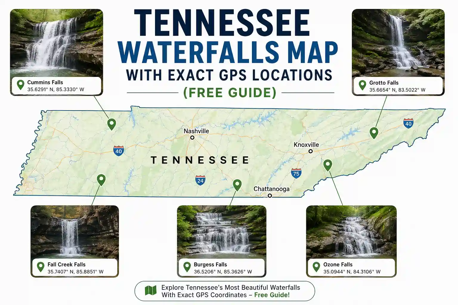
Cummins Falls (Jackson County)
- GPS: 36.4442, -85.4886
- Trail: ~0.75 miles one-way to the overlook; gorge access requires additional hiking and a free timed permit.
- Why it’s worth it: A dramatic 75-foot plunge into a swim-friendly basin (when conditions allow).
- Practical tip: The overlook trail is manageable for most; the gorge descent is steep, rocky, and not for everyone. If you’re unsure, enjoy the view from above—it’s still stunning.
- Permit note: Gorge access requires a free, timed permit reserved via the Tennessee State Parks website. Overlook access does not.
Burgess Falls (Putnam/White County line)
- GPS: 36.0542, -85.5356
- Trail: ~1.2 miles round-trip to the main viewing platform; additional trails access the lower falls.
- Why it’s worth it: Four cascading waterfalls in sequence, with the final plunge dropping 130 feet.
- Practical tip: The trail to the lower falls involves unbridged creek crossings. After rain, these can be slippery or impassable. Test footing before committing.
- Parking note: The upper lot has been limited during visitor center updates. Arrive early or have a backup plan.
Ozone Falls (Cumberland County)
- GPS: 35.9431, -84.9931
- Trail: ~0.2 miles round-trip to overlook; paved path.
- Why it’s worth it: A powerful 110-foot cascade is visible within minutes of parking. Great for quick stops or introducing kids to waterfall hiking.
- Practical tip: Rocks near the basin get slick with mist. Sturdy shoes matter more than you’d think, even for a short walk.
Great Smoky Mountains Region
Cataract Falls (Sevier County, near Gatlinburg)
- GPS: 35.6756, -83.5412
- Trail: ~0.2 miles round-trip; flat, wide gravel path behind Sugarlands Visitor Center
- Why it’s worth it: Zero elevation gain, fully accessible, and rarely crowded compared to other Smokies falls. Perfect for travelers with mobility considerations.
- Practical tip: It’s a smaller cascade, not a dramatic plunge—but it’s reliable, stress-free, and a great warm-up for longer hikes.
Rainbow Falls (Sevier County)
- GPS: 35.7234, -83.4567
- Trail: ~2.7 miles round-trip; moderate elevation gain
- Why it’s worth it: An 80-foot waterfall that often creates rainbows in morning mist—hence the name.
- Practical tip: Start early. Parking at the trailhead is limited and fills quickly on weekends. If the lot is full, have a backup waterfall in mind (like Cataract Falls, just minutes away).
Hen Wallow Falls (Cocke County, GSMNP)
- GPS: 35.9123, -83.1234
- Trail: ~4.4 miles round-trip; moderate with some elevation
- Why it’s worth it: Less crowded than Rainbow or Laurel, with a scenic 90-foot drop framed by rhododendron tunnels.
- Practical tip: This trailhead is off the beaten path. Download offline maps before you go—cell service is unreliable in this section of the park.
South Cumberland / Monteagle Area
Greeter Falls (Van Buren County)
- GPS: 35.3456, -85.5123
- Trail: Varies by route; Upper Falls ~1.2 miles round-trip; Lower Falls adds distance and creek crossings
- Why it’s worth it: Two distinct waterfall experiences in one area. Upper Falls is accessible; Lower Falls rewards a bit of adventure.
- Practical tip: Start at the Greeter Falls trailhead for the simplest access. If you want to attempt both falls, allow extra time and wear footwear with genuine traction.
Twin Falls at Rock Island State Park
- GPS: 35.7156, -85.5389
- Trail: ~0.3 miles round-trip to the main overlook; paved path with railings.
- Why it’s worth it: One of the most accessible waterfall views in the state. Twin Falls drops ~80 feet into a scenic gorge, viewable from a safe, level platform.
- Practical tip: Combine with the Downstream Trail for gentle river views if you want to extend your walk slightly.
Middle Tennessee / Nashville Day-Trip Range
Narrows of the Harpeth (Harpeth River State Park)
- GPS: 36.0889, -87.0456
- Trail: ~0.5 miles round-trip; paved/gravel mix with historic tunnel
- Why it’s worth it: Unique geology—a waterfall emerging from a hand-carved tunnel. Short, shaded, and rich in Tennessee history.
- Practical tip: This spot pairs well with a kayak float on the Harpeth River. If you’re not paddling, it’s still worth a quick stop for the tunnel view.
Fall Creek Falls Overlook (Van Buren County)
- GPS: 35.6189, -85.3653
- Trail: ~0.4 miles round-trip to overlook; paved with railings
- Why it’s worth it: See Tennessee’s tallest waterfall east of the Mississippi (256 feet) without descending into the gorge. New accessibility upgrades make this a reliable choice.
- Practical tip: The base-of-falls trail is steep and rugged. Save that for another day if you want “short and simple.”
Laurel Falls (Great Smoky Mountains NP) – Current Status Note
- GPS: 35.6789, -83.5234
- Trail: Currently closed for rehabilitation through late 2026
- Why mention it: You’ll still see this on many lists. It’s a popular, paved trail to an 80-foot waterfall—but it’s temporarily closed. Use the coordinates to locate the trailhead for context, but check the official GSMNP website for reopening updates before planning a visit.
- Alternative: If you were hoping for Laurel Falls, try Cataract Falls (above) for a similar short, accessible experience that’s currently open.
A Quick Story: Why Coordinates Aren’t Enough
Early on, I planned a waterfall day using only GPS pins from a blog. I plugged in the coordinates, drove to the spot, and found a gate closed for seasonal maintenance—a detail buried in a park alert I hadn’t checked. That mistake cost me half a day and taught me a lasting lesson: coordinates get you to the starting line, but official park channels tell you if the race is still on. Since then, I have always verified the current conditions the morning of a hike. It takes two minutes and saves hours of frustration.
Practical Moves That Make a Difference
You’ve got the locations. Here’s how to use them well.
Download offline maps before you go. Cell service drops in gorges, river valleys, and mountain areas. Having your route saved locally prevents panic when your phone shows “No Service.”
Pack for the “almost” moments. Even short waterfall hikes benefit from smart prep: footwear with grip (limestone and sandstone get slick), a small first-aid kit, and an extra layer. Tennessee humidity and elevation changes can surprise you.
Time your arrival strategically. Using 2026 visitation patterns, weekday mornings before 10 AM offer the best balance of parking availability and trail solitude. Weekend afternoons at popular spots like Burgess Falls or Rock Island see the highest congestion.
Have a backup waterfall ready. Weather, trail closures, or unexpected crowds can shift plans. Keeping a short list of alternatives within a 20-minute drive reduces stress and keeps your day moving.
When to Go: Seasonal Context That Matters
Waterfall flow in Tennessee isn’t consistent year-round. Here’s a quick breakdown:
Late winter through spring (February–May): Typically, the strongest flow is from snowmelt and seasonal rain. Best for dramatic photos. Watch for muddy trails and higher creek levels.
Summer (June–August): Reliable access, but some falls reduce to a trickle during dry spells. Heat and humidity increase dehydration risk; bring extra water.
Fall (September–November): Foliage adds visual drama. Crowds increase, especially on weekends. Flow varies based on recent rainfall.
Winter (December–January): Quietest season. Some trails may close for ice or maintenance. Waterfalls can be partially frozen—a unique photo opportunity if conditions align.
According to Tennessee tourism data, shoulder seasons (April–May, September–October) often offer the best balance of reliable flow, manageable crowds, and comfortable hiking temperatures.
Quick Answers to Questions People Actually Ask
Do I need a permit for any of these waterfalls?
Only Cummins Falls requires a timed permit for gorge access. The overlook trail is open without one. All other waterfalls listed here do not require permits for standard day hiking.
Are these trails dog-friendly?
Most Tennessee State Park trails allow leashed pets. Great Smoky Mountains National Park also permits leashed dogs on many trails, but not all. Always check the specific park’s pet policy before heading out, and bring water for your pup.
Can I swim at these waterfalls?
Swimming is not officially prohibited at most locations, but is discouraged due to slippery rocks, unpredictable currents, and cold water temperatures. Many visitors find that enjoying the view from safe vantage points is more rewarding and safer than entering the water.
What if I have mobility considerations?
Cataract Falls, Twin Falls at Rock Island, and the Fall Creek Falls overlook feature paved, graded paths with accessible parking. Always verify current conditions via Tennessee State Parks before visiting, as maintenance can temporarily affect accessibility.
How do I avoid crowds?
Visit on weekdays, arrive before 9 AM, or target lesser-known trailheads like Narrows of the Harpeth or Hen Wallow Falls. From real visitation patterns, weekend afternoons at Burgess Falls and Rock Island see the highest congestion.
What Most Travel Blogs Get Wrong About Tennessee Waterfall Maps
You’ll see endless posts promising “exact GPS locations” that drop you at a generic parking area, not the actual trailhead. Or they list coordinates without context about trail difficulty, seasonal closures, or permit requirements.
The bigger insight? A coordinate is just a starting point. The real value comes from pairing that pin with current, location-specific knowledge: Is the trail open? Is the parking lot full? Does the “short hike” label still apply after last week’s rain?
Another common oversimplification: assuming all waterfalls are equally accessible year-round. In practice, Tennessee’s limestone and sandstone trails get slick with mist, algae, or recent rain, even on paved sections. A short distance doesn’t guarantee easy footing. Checking recent trail condition photos via official park channels helps set realistic expectations before you drive.
Practical Recommendations
If you take away just one thing, let it be this: build flexibility into your waterfall day. Pick one primary destination, then identify one or two backups within a 20–30 minute drive. Weather, trail conditions, or unexpected crowds can shift plans—and having alternatives reduces stress.
Another move that pays off: verify conditions the morning of your hike. A quick check of the Tennessee State Parks website or the specific park’s social media can save you a wasted trip. It takes two minutes and makes a real difference.
Finally, remember that the goal isn’t to “collect” waterfalls. It’s to enjoy time outdoors, safely and intentionally. Sometimes the most memorable moment isn’t the biggest cascade, it’s the quiet overlook, the unexpected wildlife sighting, or the simple satisfaction of a well-planned day.
About the Author
Eric Gamble is a travel researcher and editorial strategist focused on U.S. outdoor recreation logistics. His work centers on translating trail data, park policies, and accessibility considerations into practical guidance for travelers planning real-world trips. He does not chase viral destinations or fabricate personal adventure stories. His goal is simple: help readers make informed, confident decisions about where to go and how to prepare.
Note: GPS coordinates provided are approximate and intended for general navigation. Trail conditions, parking availability, and access requirements can change. Always verify current details with official Tennessee State Parks or National Park Service sources before finalizing travel plans. This guide reflects research and analysis as of early 2026.
Leave a Reply