Burgess Falls Trail Guide: Best Viewpoints Ranked for 2026
Let’s get into it.
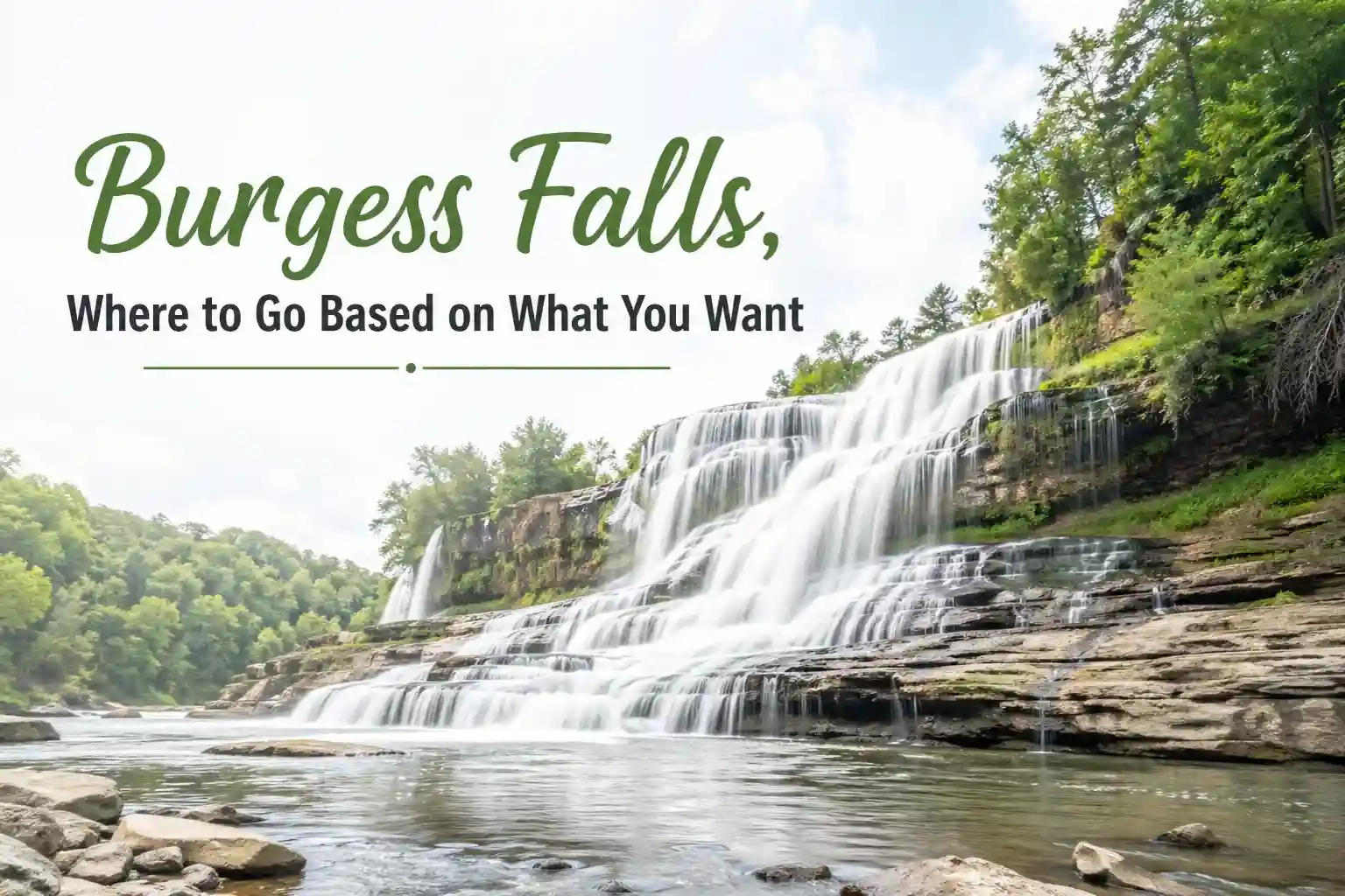
The Lay of the Land: Burgess Falls in 2026
Burgess Falls State Park sits about 70 miles east of Nashville, near Sparta, Tennessee. The main attraction is a four-tiered waterfall system where the Falling Water River drops over 250 feet total, with the final plunge clocking in around 130 feet. It’s dramatic, photogenic, and accessible enough for a wide range of visitors.
But here’s what trip reports and park updates from 2026 suggest: conditions matter more than most guides admit. The main overlook is paved and railing-protected, making it reliable year-round. The River Trail, which leads to closer views and the base area, includes uneven terrain, exposed roots, and at least one unbridged creek crossing that can get tricky after rain. Parking at the upper lot remains limited, and on weekends, the lot often fills by 9:30 AM.
According to Tennessee State Parks, the visitor center underwent renovations in late 2025, which shifted some parking dynamics. The lower lot is now the primary access point for the River Trail, while the upper lot serves the main overlook. It’s a small detail, but it changes your approach depending on which viewpoint you’re targeting.
Viewpoints Ranked: Where to Go Based on What You Want
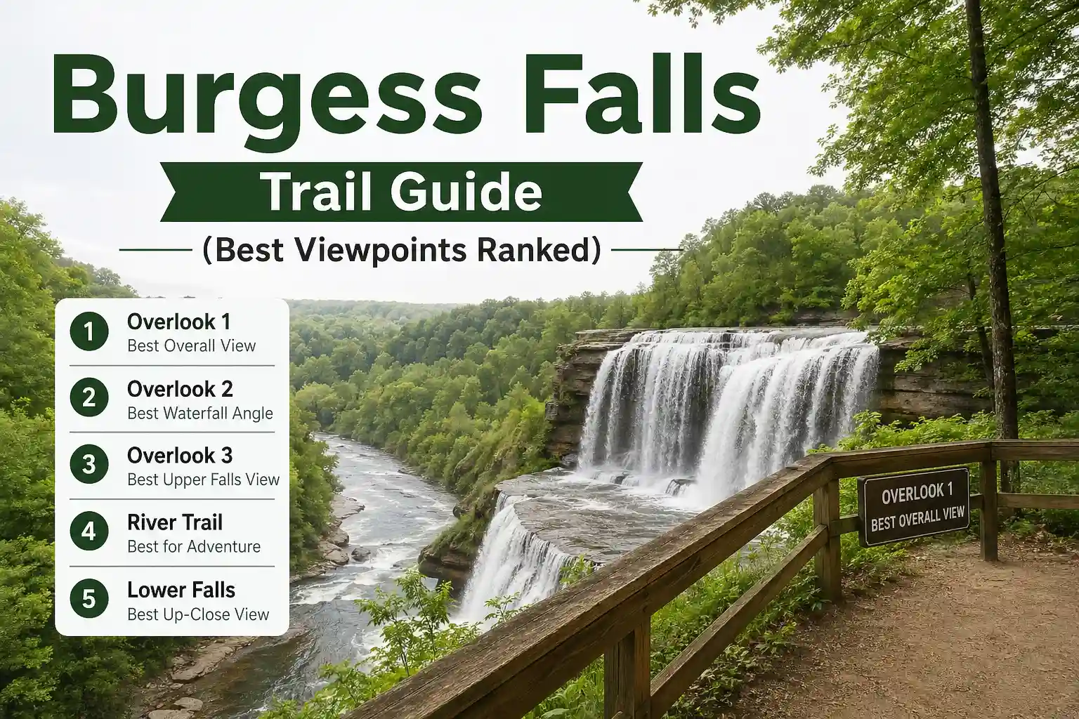
1: Lower Falls Overlook (The Iconic Shot)
- Best for: First-time visitors, photographers, families, and anyone short on time.
- Effort: Minimal—paved path, railings, under 5 minutes from parking.
- Crowd factor: High, especially on weekends and during the spring foliage season.
- Why it ranks first: This is the view you’ve seen on postcards. The full plunge frames cleanly against the gorge, with minimal foreground clutter. The paved path and safety railings make it accessible for strollers, mobility devices, and travelers who prefer certainty over adventure.
- Trade-off: You’ll share the frame with other visitors. Arrive before 9 AM or after 4 PM for softer light and fewer people in your shot.
2: River Trail Mid-Point Vista (The Quiet Alternative)
- Best for: Travelers seeking solitude, intermediate hikers, photographers wanting unique angles.
- Effort: Moderate—0.4 miles in, uneven terrain, some elevation change.
- Crowd factor: Low to moderate; many visitors turn back before this point.
- Why it ranks high: From this semi-hidden vantage, you catch the falls at an oblique angle with the river curving into the frame. It feels more discovered than staged. The trail here is less maintained, which naturally filters crowds.
- Trade-off: Footing can be slick after rain. Wear shoes with grip, and don’t push beyond your comfort zone on unstable rocks.
3: Upper Cascades Viewing Area (The Gentle Introduction)
- Best for: Families with young kids, travelers testing their hiking comfort, and birdwatchers
- Effort: Low—short, wide path from upper parking area
- Crowd factor: Moderate; often overlooked in favor of the main falls
- Why it works: The upper tiers offer a softer, layered view of the river dropping in stages. It’s less dramatic than the final plunge but rich in texture: mossy rocks, ferns, and the sound of rushing water without the gorge echo. Great for a warm-up or a cooldown.
- Trade-off: If you’re chasing the “wow” factor, this won’t deliver the same punch as the lower falls.
4: Base Area Approach (For the Adventurous)
- Best for: Confident hikers, photographers seeking close-up details, travelers comfortable with route-finding
- Effort: Moderate to challenging—requires navigating the River Trail to its end, plus careful descent near the plunge pool
- Crowd factor: Very low; most visitors don’t attempt this
- Why some love it: You’re eye-level with the power of the falls. Mist hits your lens. The sound is immersive. For detail shots or a sense of scale, nothing beats proximity.
- Trade-off: This area is unofficial and unguarded. Rocks are perpetually wet. Currents can be stronger than they appear. Tennessee State Parks does not recommend entering the plunge pool, and for good reason. Enjoy the view, but keep a safe distance.
5: Overlook from the Connector Trail (The Bonus Angle)
- Best for: Repeat visitors, hikers extending to the Fiery Gizzard system, travelers who enjoy exploration
- Effort: Moderate—requires connecting trails and a bit of navigation
- Crowd factor: Very low
- Why it’s niche: This viewpoint catches the falls from a higher, more distant perspective, with the gorge folding into the background. It’s less about the waterfall alone and more about the landscape context.
- Trade-off: Not worth the extra effort if Burgess Falls is your only destination. But if you’re already hiking the broader trail network, it’s a rewarding detour.
Making the Most of Your Visit: Practical Context That Actually Helps
Timing Isn’t Just About Light, It’s About Access
From real visitation patterns, the single biggest factor in enjoying Burgess Falls isn’t the season—it’s the hour. Weekends between 10 AM and 3 PM see the heaviest foot traffic. If you can swing a weekday morning, you’ll experience shorter paths, easier parking, and more breathing room at viewpoints.
Spring brings the strongest flow from seasonal rain, but also the muddiest trails. Summer offers reliable access but thinner water in drought years. Fall delivers foliage drama with thicker crowds. Winter can be surprisingly peaceful, though icy patches on the River Trail require extra caution.
What to Bring (Beyond the Obvious)
- Footwear with traction: Even paved areas get mist-slick. For the River Trail, grip isn’t optional.
- A small backpack: Keeps hands free for balance on uneven sections.
- A microfiber cloth: Waterfall mist fogs lenses and phone screens fast.
- A printed backup: Cell service drops in the gorge. Screenshot your route or jot down key turns.
Parking Strategy That Saves Time
The upper lot serves the main overlook and Upper Cascades. The lower lot connects to the River Trail and base approaches. If you’re targeting the Lower Falls Overlook, start at the upper lot. If you plan to hike the River Trail, park below to avoid backtracking. On busy days, arriving after 3 PM can mean waiting for a spot—factor that into your schedule.
What Most Guides Skip About Burgess Falls Viewpoints
You’ll find plenty of articles listing “best waterfall hikes” that include Burgess Falls with a generic “easy trail, great views” tagline. That’s not wrong, but it’s incomplete. The real insight? Not all viewpoints are created equal—and the “best” one depends entirely on what you’re optimizing for.
Some travelers want the iconic photo with minimal effort. For them, the Lower Falls Overlook is objectively the right choice. Others prioritize solitude or unique angles. For them, pushing a little farther on the River Trail pays off. Many guides treat the trail as a single experience, but in practice, it’s a menu of options with different effort-to-reward ratios.
Another gap: safety nuance. The base area near the plunge pool looks inviting in photos, but the rocks are perpetually wet, and the current can pull unexpectedly. Park signage discourages entering the water, yet few articles explain why. A better approach: enjoy the power of the falls from a respectful distance. The view doesn’t improve by risking a slip.
Tailoring Your Visit: Scenarios That Match Real Travelers
You have 90 minutes and want the classic shot
Park at the upper lot, walk to the Lower Falls Overlook, spend 20 minutes photographing, then explore the Upper Cascades on your way back. Skip the River Trail unless conditions are dry and you’re moving quickly.
You’re traveling with kids under 8
Stick to the paved overlooks. The Lower Falls viewpoint offers railings and short walking distances. Bring snacks and a change of shoes—mist can soak hems, and small feet get tired faster on uneven ground.
You want photos without crowds in the frame
Visit on a weekday morning, or try the River Trail mid-point vista. Most visitors don’t push beyond the main overlook, so a little extra walking buys significant solitude.
You’re an intermediate hiker looking to extend the adventure
Combine the River Trail to the base area with a connector to the Fiery Gizzard system. This creates a 3–4 mile loop with varied terrain and multiple waterfall perspectives. Check trail conditions first—recent rain can make extensions muddy.
You have mobility considerations
The Lower Falls Overlook and Upper Cascades viewing areas are your most reliable options. Both feature paved or packed surfaces with railings. The River Trail includes roots, rocks, and elevation changes that may not suit all mobility needs.
Questions People Actually Ask (Answered Without Fluff)
Is the River Trail safe after rain?
It depends on how much rain and how recently. Light showers may just make rocks slick. Heavy rain can raise creek levels and obscure footing. If you’re unsure, stick to the paved overlooks. Safety isn’t about toughness—it’s about reading conditions honestly.
Can I bring my dog?
Yes, leashed pets are welcome on park trails. Keep in mind that the River Trail’s uneven terrain and creek crossings can be challenging for small or older dogs. Bring water for them, and clean up after.
Are there restrooms at the trailheads?
Yes, facilities are available near the visitor center and lower parking area. The upper overlook does not have restrooms, so plan accordingly if you’re starting there.
Is swimming allowed at the base of the falls?
While not explicitly prohibited in all park materials, entering the plunge pool is strongly discouraged due to slippery rocks, unpredictable currents, and cold water temperatures. Many visitors find that enjoying the view from stable ground is more rewarding—and far safer—than attempting to wade.
What’s the best season for waterfall flow?
Late winter through spring typically offers the strongest flow from seasonal precipitation. Summer visits can still be beautiful, but extended dry periods may reduce the falls to a thinner cascade. Check the recent weather before setting expectations.
Do I need a reservation or permit?
No permits are required for day use. A small day-use fee may apply; check the Tennessee State Parks website for current details.
Practical Recommendations
If you’re visiting Burgess Falls for the first time, start simple. Park at the upper lot, walk to the Lower Falls Overlook, and let that view set your expectations. From there, you can decide whether to extend your hike based on energy, time, and trail conditions. This “anchor and assess” approach reduces pressure and keeps options open.
For photography, overcast days often yield better results than bright sun. Harsh midday light creates deep shadows in the gorge, while cloud cover softens contrast and reduces glare off wet rocks. If you’re chasing golden hour, late afternoon light warms the stone faces beautifully—but be prepared for crowds during peak foliage season.
When in doubt, prioritize safety over scenery. The views from stable, designated areas are still spectacular. Pushing beyond your comfort zone for a slightly different angle rarely pays off if it means risking a fall or getting caught in rising water.
Leave a Reply