
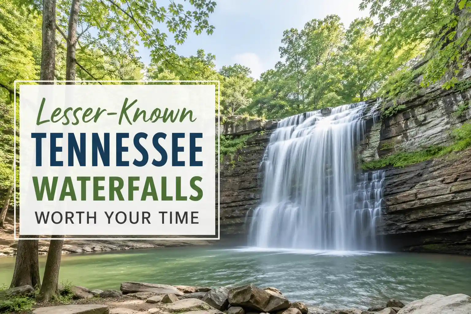
17 Hidden Waterfalls in Tennessee Locals Don’t Tell Tourists About (2026 List)
This isn’t about gatekeeping. It’s about redirecting foot traffic to places that can handle it, with honest details about access, effort, and what you’re actually walking into. No hype. No recycled blog fodder. Just seventeen waterfalls are worth the drive, with the context you won’t find in a generic listicle.
The List: Lesser-Known Tennessee Waterfalls Worth Your Time
Denny Cove Falls (Marion County)
A 3.5-mile loop through hardwood forest leads to a 60-foot cascade that drops into a quiet pool. The trail is moderate—some elevation, a few rocky sections—but rarely crowded on weekdays. What makes it special: the cove itself feels enclosed, almost private, with moss-covered walls framing the falls. Access via the Denny Cove trailhead off Highway 28. Check Tennessee State Parks alerts before heading out; creek levels shift after rain.
Hemlock Falls (South Cumberland State Park, lesser-used approach)
Most visitors hit Hemlock Falls from the main trailhead. Fewer know about the approach via the Stone Door connector, which adds mileage but cuts crowd density significantly. The falls themselves are dramatic—a wide, multi-tiered drop—but the real reward is the solitude if you time it right. Weekday mornings, especially outside peak foliage season, make a noticeable difference.
Big Creek Falls (Cherokee National Forest, Unicoi County)
Not to be confused with the more popular Big Creek area in GSMNP. This Unicoi County gem requires a short but rugged hike through mixed forest. The payoff: a slender, 80-foot plunge into a rocky basin. Trail conditions vary seasonally; sturdy footwear matters more than you’d expect. No facilities at the trailhead, so pack accordingly.
Indian Creek Falls (Tellico Plains area)
A modest cascade, but the setting elevates it. The trail follows a clear, shallow creek through rhododendron tunnels. In late spring, wildflowers line the path. The falls themselves are gentle—more serene than spectacular—but the overall experience feels removed from typical tourist circuits. Access via Forest Service roads; a high-clearance vehicle helps after wet weather.
Fall Branch Falls (Gatlinburg vicinity)
Often overshadowed by nearby heavy-hitters, this short hike leads to a quiet, multi-step cascade. The trail is well-maintained but sees far fewer visitors than Laurel or Rainbow Falls. Ideal for travelers who want a waterfall moment without the shoulder-to-shoulder foot traffic. Parking is limited; arrive before 10 AM on weekends.
Hen Wallow Falls (Great Smoky Mountains NP)
Yes, it appears on some lists—but it’s still under-visited relative to its beauty. A moderate 4.4-mile round-trip hike (with elevation gain) leads to a graceful, 90-foot drop framed by rhododendron. The trail sees fewer families with small kids due to the distance, which works in your favor if you’re seeking quiet. Bear country protocols apply; carry bear spray and know how to use it.
Muddy Branch Falls (Great Smoky Mountains NP)
This one requires creek crossings and route-finding skills. Not for beginners. But for confident hikers, the reward is a secluded cascade in a narrow gorge. The trail isn’t officially marked in all sections, so downloading a GPX track beforehand is wise. Water levels dictate accessibility—skip it after heavy rain.
Buckeye Falls (Great Smoky Mountains NP, near Cades Cove)
Most Cades Cove visitors drive the loop and stop at the big-name sights. Buckeye Falls, accessible via a short connector from the Primitive Baptist Church trail, offers a quiet alternative. The falls are modest but the setting—a quiet forest with minimal foot traffic—makes it worthwhile. Combine with a bike ride through the cove for a fuller experience.
Turkey Creek Falls (Townsend side of GSMNP)
Townsend markets itself as the “quiet side of the Smokies,” and this waterfall delivers on that promise. A gentle 1.5-mile round-trip hike leads to a pleasant cascade. The trail is wide and well-maintained, suitable for most fitness levels. Weekday visits virtually guarantee solitude.
Meigs Creek Falls (Great Smoky Mountains NP)
One of the shortest hikes on this list—under half a mile round-trip—but often missed because it lacks a big-name reputation. The falls are small but charming, with a gentle flow over layered rock. Perfect for travelers with limited mobility or time. The trailhead sits off a quiet road; parking holds about six vehicles.
Lynn Camp Prong Falls (Great Smoky Mountains NP)
Remote, rugged, and rewarding. This hike requires commitment: roughly 7 miles round-trip with significant elevation change. The falls themselves are a series of cascades in a secluded valley. Cell service is nonexistent. Share your itinerary with someone before heading in. Best attempted by experienced hikers with proper gear.
Douglas Falls (Cosby entrance area, GSMNP)
A short, steep trail leads to a powerful cascade that feels bigger than its height suggests. The Cosby entrance sees far fewer visitors than Gatlinburg or Townsend, which translates to lighter trail traffic. Parking is informal; arrive early to secure a spot. Trail conditions can be muddy—footwear with traction is essential.
Clear Creek Falls (Van Buren County)
Not to be confused with similarly named falls elsewhere. This Van Buren County cascade is accessible via a short, unmarked path off a forest service road. The falls drop into a rocky pool suitable for wading in warm months. No facilities, no signage—just a quiet natural feature. Respect private property boundaries; park only in designated pull-offs.
Falls Creek Falls (Van Buren County)
Different from Fall Creek Falls State Park. This lesser-known cascade sits on public land but receives minimal promotion. A moderate hike through mixed forest leads to a wide, multi-tiered drop. The trail can be faint in sections; downloading an offline map is wise. Weekday visits dramatically improve the experience.
Savage Gulf side cascades (South Cumberland State Park)
The Savage Gulf area has multiple small, unnamed cascades along its rim trails. While not “destination” waterfalls, they offer spontaneous, quiet moments for hikers willing to explore beyond the main overlooks. Stick to marked trails; the terrain is rugged and unforgiving if you wander off-path.
Fiery Gizzard side-trip falls (South Cumberland State Park)
The Fiery Gizzard trail is known for its main attractions, but several small, unnamed cascades appear along side drainages. These arent signposted. They’re discovered by attentive hikers who slow down and listen for water. If you go this route, carry a physical map and let someone know your plan.
Stone Door area seasonal falls (South Cumberland State Park)
After significant rainfall, temporary cascades appear along the Stone Door rim trail. They’re not permanent features, which is why they rarely appear on lists. But if you time your visit right—24-48 hours after a soaking rain—you might catch a fleeting, dramatic flow. Check recent precipitation before driving.
What Most Travel Blogs Get Wrong About “Hidden” Tennessee Waterfalls

Here’s the uncomfortable truth: calling a waterfall “hidden” because it’s not in Gatlinburg doesn’t make it secret. It just means the blog writer hasn’t been paying attention.
The bigger issue? Many lists ignore access realities. A trail might be “short” on paper but require crossing private land, navigating unmarked paths, or wading through creeks that become dangerous after rain. That’s not helpful guidance—that’s a liability.
Another oversimplification: assuming all waterfalls are equally accessible year-round. In practice, spring runoff can close creek crossings. Summer drought can reduce flows to a trickle. Fall foliage draws crowds that transform quiet trails into congested corridors. The smart approach: check recent conditions via official park channels, not just static blog posts.
Also worth noting: “hidden” doesn’t mean “no impact.” Even low-traffic trails suffer from erosion, litter, and off-trail damage when visitation spikes. The most responsible way to enjoy these places is to follow Leave No Trace principles, stay on marked paths, and avoid sharing precise GPS coordinates for fragile locations.
Practical Recommendations
Start with one waterfall per day. Trying to hit multiple lesser-known spots in a single outing often leads to rushed experiences, missed trail markers, or fatigue that undermines safety. Pick a primary goal, build buffer time for unexpected delays, and keep a backup option nearby in case conditions change.
Footwear matters more than distance. A “short” hike on wet limestone or muddy clay can be more treacherous than a longer trek on well-maintained gravel. Trail runners with aggressive tread or hiking shoes with ankle support tend to perform better than casual sneakers in Tennessee’s variable terrain.
Timing isn’t just about avoiding crowds. Light quality, water flow, and trail conditions shift throughout the day. Early morning often yields softer light for photography, cooler temperatures for hiking, and lower chances of afternoon thunderstorms in the summer months. If solitude is your priority, weekday visits before 9 AM consistently deliver.
When in doubt, verify. Park websites, ranger stations, and official social media accounts post real-time updates about trail closures, parking status, and weather impacts. A five-minute check before you drive can save a wasted trip.
Leave a Reply