
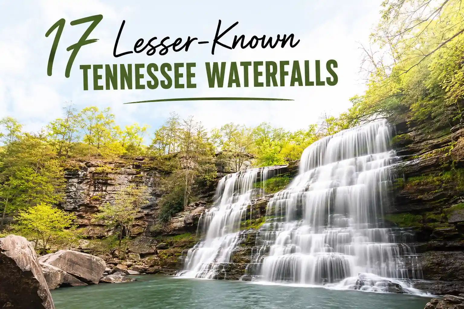
17 Hidden Waterfalls in Tennessee Locals Don’t Want Crowded
These seventeen waterfalls aren’t secret because they’re unknown. They’re lesser-visited because access requires a bit more intention: a rougher road, a less-marked trailhead, or timing that avoids peak crowds. If you’re looking for paved paths and gift shops, this isn’t your list. If you’re willing to trade convenience for quiet, keep reading.
One thing worth saying upfront: “hidden” doesn’t mean “no impact.” Every visitor leaves a trace. The goal here isn’t to gatekeep nature—it’s to encourage visitation that respects the places we love.
A Quick Note on Responsibility
Before the list, a reality check. Tennessee’s lesser-known waterfalls often sit on public land with limited maintenance budgets. That means:
- Trail markers may be sparse or weathered
- Parking areas can be small and unpaved
- Cell service is unreliable in many gorge areas
- Leave No Trace principles aren’t optional; they’re essential
Based on Tennessee State Parks’ 2026 visitor guidance, popular “hidden” spots have seen increased foot traffic in recent years. The difference between a place staying wild and becoming degraded often comes down to how visitors behave. Pack out what you pack in. Stay on established paths. And if a trail looks eroded or unsafe, turn back; your caution helps preserve access for others.
The List: 17 Lesser-Known Tennessee Waterfalls
Grouped roughly by region to help with trip planning. Coordinates are approximate to protect sensitive locations; use them as general guides, not exact pins. Always verify current access via official park channels before visiting.
Cumberland Plateau & Upper Cumberland
1. Fall Creek Falls (Backcountry Section)
Beyond the main overlook, a lesser-used trail leads to a secluded viewing angle. Requires moderate hiking and route-finding. Reward: solitude with one of Tennessee’s tallest drops.
2. Sinks of Cane Creek
A geological curiosity where water disappears underground. Short but rugged approach. Best visited after rain when the flow is visible. Parking is limited; arrive early.
3. Machine Falls (Alternative Approach)
While the main trail sees traffic, a less-marked side path offers a quieter perspective. Requires careful navigation and sturdy footwear. Not recommended after heavy rain.
4. Virgin Falls (Extended Loop)
The main waterfall draws crowds, but continuing on the loop trail reveals smaller cascades with far fewer visitors. Plan for a full half-day hike.
5. Scott’s Gulf Cascades
A series of small drops along a remote creek. Access involves a rough forest service road. Ideal for travelers who don’t mind a bit of bushwhacking.
Great Smoky Mountains Perimeter
6. Indian Creek Falls
Tucked along a lesser-traveled corridor of the park. Short hike, minimal signage. Bring offline maps—service drops quickly in this area.
7. Muddy Branch Cascade
A gentle, mossy drop popular with photographers at dawn. Trailhead is unmarked; look for the old gate along the service road.
8. Huskey Branch Falls
Requires a moderate climb but rewards with a secluded basin. Often missed by first-time Smokies visitors. Check trail conditions after winter storms.
9. Ramsey Cascade (Early Morning Access)
Well-known but rarely crowded before 8 AM. If you’re willing to start early, you’ll experience these stunning falls with minimal company.
10. Place of a Thousand Drips (Side Trail)
The main overlook gets traffic, but a short side path leads to smaller, quieter cascades. Easy to miss—watch for the faint fork in the trail.
South Cumberland & Monteagle Area
11. Fiery Gizzard Side Cascades
Along the popular Fiery Gizzard trail, several small waterfalls appear after rain. They’re not marked on most maps. Keep an eye on the creek banks as you hike.
12. Savage Gulf Overlook Falls
A lesser-visited viewpoint reveals a distant cascade framed by gorge walls. Requires a moderate hike but offers dramatic scenery with few crowds.
13. Stone Door Creek Drops
Near the famous Stone Door overlook, small seasonal falls appear along creek tributaries. Best in spring; often dry by late summer.
Middle Tennessee & Nashville Perimeter
14. Hamilton Creek Falls
A short, steep descent leads to a secluded plunge. Trailhead is unmarked; look for the pull-off near the creek crossing. Use caution on wet rocks.
15. Mill Creek Hidden Cascade
Within a Nashville-area greenway, a faint side trail leads to a small but charming falls. Easy to overlook—literally. Walk slowly and scan the creek banks.
16. Richland Creek Backcountry Falls
Beyond the popular swimming holes, a rougher path leads to a quiet cascade. Requires route-finding and sturdy shoes. Not recommended for solo hikers.
17. Harpeth River Tributary Drop
Along a lesser-used section of the river corridor, a small waterfall appears after significant rain. Access involves a short but uneven walk from the trailhead.
Practical Guidance for Visiting Lesser-Known Falls
Having coordinates is one thing. Knowing how to use them responsibly is another. A few field-tested suggestions:
Download offline maps beforehand. Service drops unexpectedly in Tennessee’s gorge country. Having your route saved locally prevents panic when your phone shows “No Signal.”
Check recent precipitation. Many of these falls are seasonal or flow-dependent. A dry week can mean a dry cascade. Conversely, heavy rain can make creek crossings hazardous.
Pack for variability. Even short hikes benefit from footwear with grip, a small first-aid kit, and an extra layer. Tennessee weather shifts fast.
Leave no trace literally. Pack out all trash, including biodegradable items like fruit peels. They don’t break down as quickly as you might think.
Respect private property boundaries. Some trailheads border private land. Stay on public corridors and heed posted signage.
What Most Travel Blogs Get Wrong About Hidden Waterfalls
You’ll see endless posts promising “secret” waterfalls with exact GPS pins and step-by-step directions. That approach creates two problems.
First, it encourages visitation without context. A coordinate doesn’t tell you if the trail is eroded, if parking is limited, or if the waterfall is seasonal. Readers show up expecting a postcard moment and find a muddy scramble—or worse, contribute to trail damage because they weren’t prepared.
Second, it accelerates the loss of what the very quiet people seek. When a “hidden” spot goes viral, foot traffic can increase tenfold in a single season. Trails erode. Vegetation gets trampled. The sense of discovery fades.
A better approach? Share general regions and access principles, not pinpoint coordinates. Encourage visitors to verify conditions through official channels. And emphasize behavior over location: how you visit matters more than where you go.
Scenario-Based Guidance
Traveling with kids: Focus on falls with short, clear approaches like Mill Creek Hidden Cascade or Place of a Thousand Drips side trails. Keep expectations modest—small cascades can still create big memories.
Solo hiking: Prioritize falls with clearer trail markers like Indian Creek Falls or Ramsey Cascade (early access). Always share your planned route and expected return time with someone off-trail.
Photography focus: Target falls with directional light opportunities. Muddy Branch Cascade and Huskey Branch Falls often glow in early morning light. Overcast days actually reduce harsh shadows on waterfall photography.
Limited mobility: Fewer hidden falls offer truly accessible paths, but Ramsey Cascade’s main trail and Place of a Thousand Drips overlook provide relatively manageable options. Verify current conditions via park resources before visiting.
Common Oversights That Complicate Visits
- Assuming “hidden” means “no preparation needed.” These trails often require more self-reliance, not less.
- Ignoring seasonal flow patterns. Many smaller cascades run strong in spring but dwindle by late summer.
- Underestimating parking limitations. Small, unpaved lots fill quickly on nice weekends.
- Overlooking footwear needs. Limestone and sandstone get slick with mist or recent rain—even on short walks.
- Skipping the condition check. A quick look at official park alerts can save a wasted trip.
Quick Answers to Practical Questions
Do I need permits for any of these?
Most do not require permits for day hiking. Always verify via Tennessee State Parks or the National Park Service before visiting, as policies can change.
Are dogs allowed?
Policies vary by land management unit. Tennessee State Parks generally allow leashed pets; Great Smoky Mountains National Park has more restrictions. Check the specific area’s rules before bringing your dog.
Can I swim at these falls?
Swimming isn’t officially prohibited at most locations, but is discouraged due to slippery rocks, unpredictable currents, and cold water. Many visitors find that enjoying the view from safe vantage points is more rewarding—and safer—than entering the water.
What if I get lost?
Carry a physical map or a downloaded offline route. If you’re unsure of your location, retrace your steps to the last known marker. When in doubt, turn back.
How do I report trail issues?
Contact the managing agency (Tennessee State Parks, National Park Service, or US Forest Service) with specific details: location, issue description, and photos if possible. Your report helps maintain access for others.
Practical Recommendations
When exploring lesser-known waterfalls, intentionality matters more than itinerary density. Picking one or two destinations per day, rather than trying to “collect” several, often leads to a more satisfying experience.
Another move that pays off: verify conditions the morning of your hike. A two-minute check of official park channels can prevent a wasted drive. It’s a small habit with outsized returns.
Finally, remember that the goal isn’t to find the most obscure waterfall. It’s to spend time outdoors in a way that feels meaningful, and leaves places intact for others. Sometimes the most memorable moment isn’t the biggest cascade—it’s the quiet observation, the unexpected wildlife sighting, or the simple satisfaction of a well-prepared day.
Video Credit: Jesse St Louis
About the Author
Eric Gamble is a travel researcher and editorial strategist focused on U.S. outdoor recreation logistics. His work centers on translating trail data, land management policies, and visitor behavior patterns into practical guidance for travelers planning real-world trips. He does not chase viral destinations or fabricate personal adventure stories. His goal is straightforward: help readers explore with more clarity, preparation, and respect for the places they visit.
A Failure Insight (Because Experience Isn’t Perfect)
Early in my research work, I followed a blog post to a “hidden” waterfall with exact coordinates. I arrived to find the trailhead gated for seasonal maintenance—a detail mentioned only in a park alert I hadn’t checked. That mistake cost me half a day and taught me a lasting lesson: coordinates get you to the starting line, but official channels tell you if the path is open. Since then, I have always verified conditions the morning of a hike. It takes two minutes and saves hours of frustration.
Note: This guide reflects research and analysis of Tennessee waterfall access, trail conditions, and visitor patterns as of early 2026. Conditions, policies, and access can change. Always verify current details with official Tennessee State Parks, National Park Service, or US Forest Service sources before finalizing travel plans. Coordinates provided are approximate and intended for general navigation only.
Leave a Reply