North Cascades Highway Road Trip: The Cascade Loop in 5 Days
Turquoise lakes, granite spires and a highway that closes under snow half the year. Our five-day Cascade Loop from Seattle over the North Cascades Highway, through Leavenworth, Lake Chelan, the Methow Valley and back by Whidbey Island.

The North Cascades Highway, Washington State Route 20, is open roughly from May to November and is best driven from July through September. Most travelers combine it with the Cascade Loop, a 440-mile circuit from Seattle that takes about five days. Head east on US-2 over Stevens Pass to Leavenworth, continue to Lake Chelan and the Methow Valley, cross the North Cascades on SR-20 past Washington Pass and Diablo Lake, then return through the Skagit Valley and Whidbey Island. North Cascades National Park has no entrance fee, but there is no gas for about 70 miles between Mazama and Marblemount.
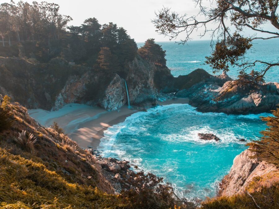
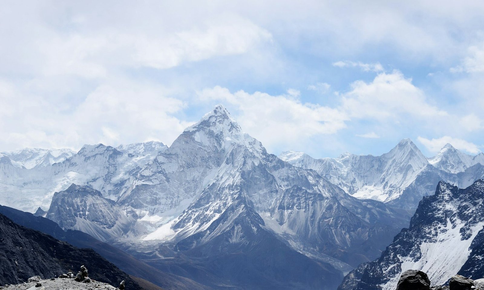
North Cascades National Park is one of the least visited national parks in the lower 48 states, even though it sits about two hours from Seattle. Part of the reason is that almost all of it is wilderness. There are no roads into the heart of the park, only the highway that skirts its edge through the Ross Lake National Recreation Area. The views from that road are what most people come for: jagged granite spires, more than 300 glaciers in the wider park complex, waterfalls dropping off cliffs and two lakes, Diablo and Ross, so bright a shade of turquoise that first-time visitors assume the photos are edited. The color comes from glacial flour, fine rock ground by glaciers and suspended in the water, which reflects green and blue light.
The highway itself is a piece of history. It took decades to build and opened in 1972, finally connecting western and eastern Washington across the northern Cascades. Because of avalanche danger, a 37-mile section between the Ross Lake area and the Silver Star gate near Mazama closes every winter, usually from November until spring. Crews then spend weeks clearing snow that can reach more than 20 feet deep at the passes. That closure is why timing matters on this trip more than on almost any other road trip in the country.
- ≈440 miThe full Cascade Loop from Seattle
- 1972Year SR-20 opened across the mountains
- 5,477 ftWashington Pass, the highest point on the road
- $0Entrance fee for North Cascades National Park
The route at a glance
| Day | Stretch | Highlights | Overnight |
|---|---|---|---|
| 1 | Seattle to Leavenworth (≈120 mi) | Snoqualmie or Stevens Pass, Deception Falls, Bavarian village | Leavenworth |
| 2 | Leavenworth to Lake Chelan (≈60 mi) | Icicle Creek, Wenatchee orchards, lake beaches and wineries | Chelan |
| 3 | Chelan to Winthrop (≈60 mi) | Methow Valley, Twisp, Old West storefronts | Winthrop or Mazama |
| 4 | Winthrop to Newhalem (≈90 mi) | Washington Pass, Rainy Pass hikes, Diablo Lake Overlook | Newhalem campground, Marblemount or Concrete |
| 5 | Newhalem to Seattle via Whidbey (≈150 mi with ferry) | Skagit Valley, La Conner, Deception Pass, Mukilteo ferry | Home |
You can drive the loop in either direction. Going counterclockwise, as above, saves the most dramatic mountain scenery for the second half and puts the sun behind you on the west side of Washington Pass in the afternoon. If you only have two or three days, drive straight from Seattle to the North Cascades on SR-20, spend a night in Winthrop and return the same way.
Day 1: Seattle to Leavenworth over Stevens Pass
Leave Seattle on I-5 north to Everett, then follow US-2 east along the Skykomish River. The road climbs through small towns like Gold Bar and Index, where the sheer granite wall of Mount Index rises straight above the river and climbers hang from the cliffs. Stop at Wallace Falls State Park near Gold Bar if you want a hike; the trail to the middle falls is about 5 miles round trip with a good view of a 265-foot drop.
Past Skykomish, the highway climbs to Stevens Pass at 4,061 feet, a ski area in winter and a mountain biking spot in summer. A few miles down the eastern side, Deception Falls has a short loop trail beside a roaring cascade, and it’s an easy leg stretch.
Once you drop out of the mountains, the climate changes completely. The western slopes are wet, mossy and dark with cedar and hemlock forest; the eastern side is drier, sunnier and covered in ponderosa pine. In Tumwater Canyon, the Wenatchee River crashes through boulders beside the road, and in October the larches and maples turn gold.
Leavenworth is an old logging and railroad town that reinvented itself in the 1960s as a Bavarian village to bring in tourists. Every building on Front Street has German-style painted facades, and restaurants serve bratwurst, pretzels and beer in steins. It is unapologetically kitschy, but the setting under the Enchantment Peaks is spectacular. The town is extremely busy during Oktoberfest weekends in October and the Christmas lighting festival in December, so book early if your dates overlap.
Day 2: Icicle Creek and Lake Chelan
Spend the morning in Icicle Canyon, just west of Leavenworth, where trails follow the creek and lead into the Alpine Lakes Wilderness. The famous Enchantments, a basin of granite and turquoise lakes, require a permit from a competitive lottery for overnight trips, but day hikes like the Icicle Gorge loop, about 4 miles, are open to anyone. Note that most trailheads in the national forest require a Northwest Forest Pass or an America the Beautiful pass.
Drive east to Wenatchee, the self-described apple capital of the world, where fruit stands sell apples, cherries and peaches in season. Then follow US-97A north along the Columbia River to Lake Chelan. This narrow glacial lake stretches about 50 miles into the mountains and is one of the deepest lakes in the United States, close to 1,500 feet at its deepest point. The town of Chelan at its southern end is a summer resort with beaches, boat rentals and a growing number of wineries on the surrounding hills.
The far end of the lake is home to Stehekin, a tiny community with no road access. You can reach it only by boat, floatplane or a long hike. The Lady of the Lake passenger ferry runs from Chelan up the lake, and in summer you can take a day trip with a short stop, or stay overnight to visit Rainbow Falls and the Stehekin Pastry Company. Stehekin is part of the Lake Chelan National Recreation Area, managed with North Cascades National Park, and it feels like a different century. If you have an extra day, this is the place to use it.
Day 3: The Methow Valley and Winthrop
From Chelan, take SR-153 north along the Methow River into the Methow Valley, a broad, sunny valley of ranches, aspen groves and hay fields framed by mountains. It is one of the best places in the Northwest for cross-country skiing in winter and mountain biking and hiking in summer. Twisp has a small arts scene and good bakeries.
Winthrop is the valley’s main tourist town, built in an Old West style with wooden boardwalks, false-front stores and hitching posts. Like Leavenworth, it adopted its theme in the 1970s to attract travelers on the newly opened highway. The Shafer Historical Museum has old mining equipment and pioneer buildings. Rent a bike or tube on the Methow River on a hot afternoon. Further up the valley, Mazama is a tiny settlement with a famous general store that stocks everything from sandwiches to climbing gear, and a good base for early starts to the pass.
Fill your tank in Winthrop or Mazama. This is your last gas station for about 70 miles.
Day 4: Washington Pass, Rainy Pass and Diablo Lake
This is the heart of the trip, so start early. From Mazama, SR-20 climbs through switchbacks to Washington Pass Overlook, at about 5,477 feet. A short paved path leads to a viewpoint where the road curves in a hairpin far below, and the granite spire of Liberty Bell Mountain and the Early Winters Spires rise right above you. In early summer, snow still lines the road. In late September and early October, the golden larches on the slopes make this one of the best fall foliage drives in the West.
A few miles west, Rainy Pass at 4,855 feet is where the Pacific Crest Trail crosses the highway. It is also the start of some of the best day hikes in the region.
| Hike | Distance round trip | Difficulty | Why go |
|---|---|---|---|
| Rainy Lake | About 2 mi | Easy, paved | A glacier-fed lake below cliffs and waterfalls |
| Washington Pass Overlook path | Under 0.5 mi | Easy | Liberty Bell views and the hairpin curve |
| Blue Lake | About 4.4 mi | Moderate | A turquoise lake under Early Winters Spires |
| Maple Pass Loop | About 7 mi | Strenuous | Ridge-top views of lakes and peaks; larches in fall |
| Thunder Knob | About 3.6 mi | Moderate | A view over Diablo Lake from above |
Snow can cover the higher trails until mid-July. Pack layers, rain gear and the ten essentials, since mountain weather here changes fast even in summer.
Continue west and down to Ross Lake and the Diablo Lake Overlook, the most photographed spot on the highway. From the parking area, the lake shines bright turquoise between forested ridges, with Colonial and Pyramid peaks and their glaciers above. The color is strongest on sunny afternoons in mid to late summer, when glacial melt is high. Ross Lake, Diablo Lake and Gorge Lake are reservoirs created by dams built by Seattle City Light to generate electricity for the city. Ross Lake Resort rents floating cabins on Ross Lake, reachable only by boat and trail, and is one of the most unusual places to stay in Washington.
Near the overlook, the Diablo Lake Trail follows the north shore, and the North Cascades Institute runs an environmental learning center on the lake. Further west, the Gorge Creek Falls viewpoint has a grated bridge where you can look straight down into the gorge.
End the day in Newhalem, a small company town built by Seattle City Light for dam workers. The North Cascades National Park Visitor Center has exhibits, a short boardwalk trail and rangers who can help with backcountry plans. Behind the town’s powerhouse, a short trail leads to Ladder Creek Falls, lit with colored lights at night. Camp at Newhalem Creek or Colonial Creek campgrounds, or stay in Marblemount or Concrete, where options are basic.
Day 5: Skagit Valley, La Conner and Whidbey Island
Follow SR-20 west along the Skagit River, a wild and scenic river famous for salmon and, from December to February, for one of the largest winter gatherings of bald eagles in the lower 48. The eagles come to feed on spawning salmon near Rockport and Marblemount. That stretch of road stays open in winter even when the passes are closed, so an eagle-watching day trip from Seattle is possible.
In the Skagit Valley, the road crosses rich farmland. In April, fields around Mount Vernon and La Conner bloom with tulips and daffodils during the Skagit Valley Tulip Festival, which draws huge crowds. The small waterfront town of La Conner has art galleries, a museum of Northwest art and a quilt museum, and it is a good lunch stop any time of year.
Then cross Deception Pass, where a narrow, dramatic bridge built in 1935 spans a tidal channel between Fidalgo and Whidbey islands, about 180 feet above swirling currents. Deception Pass State Park is one of the most visited state parks in Washington, with beaches, old-growth forest and trails along the cliffs. Park and walk out onto the bridge for the view.
Drive south down Whidbey Island, past Oak Harbor and the historic town of Coupeville, with its wooden wharf and Penn Cove mussels, then catch the Clinton–Mukilteo ferry back to the mainland. The crossing takes about 20 minutes, and lines can be long on summer Sunday afternoons. From Mukilteo, Seattle is about 40 minutes south.
When SR-20 is open
The Washington State Department of Transportation closes the North Cascades Highway between milepost 134, near the Ross Dam trailhead, and milepost 171, at the Silver Star gate, every winter because of avalanche danger. Closing usually happens in November, after the first big storms. Reopening depends on snow and avalanche conditions and has ranged from late March to mid-May in recent decades. WSDOT posts updates on its website and social media as crews clear the road. The western section from the Skagit Valley to Diablo, and the eastern section from Winthrop to Mazama, generally stay open year-round.
| Season | Road and trails | Weather | Crowds |
|---|---|---|---|
| Late April–June | Pass usually open; high trails snowy | Cool, waterfalls at peak | Light |
| July–August | All open; best hiking | Warm and dry, wildfire smoke possible | Busiest |
| September–mid-October | Open; larches turn gold | Crisp, early snow possible at passes | Moderate, busy on larch weekends |
| November–April | Pass closed; lower valleys open | Snow and rain | Very light |
Wildfire is a growing concern. Smoke from fires in Washington and British Columbia can blanket the mountains in August and September, hiding the views, and fires have closed SR-20 in several recent summers. Check WSDOT and the park’s alerts before you go, and keep your itinerary flexible.
What it costs
| Expense | Budget | Mid-range | Notes |
|---|---|---|---|
| Lodging per night | $30–$40 camping | $160–$300 hotel or lodge | Leavenworth and Chelan peak in summer and fall |
| Gas for ≈440 miles | $75–$110 | $75–$110 | Washington gas prices are among the highest in the country |
| Food per person per day | $35–$50 | $70–$110 | Picnics work well; few restaurants on SR-20 |
| Passes, ferries and boats | $30–$60 | $100–$200 | Forest pass, Whidbey ferry, optional Lady of the Lake |
North Cascades National Park itself has no entrance fee. Washington State Parks require a Discover Pass for parking, and national forest trailheads usually need a Northwest Forest Pass or an interagency pass. For budgeting longer routes, see our road trip cost guide.
Where to stay
Lodging is limited along SR-20 itself, so book early for summer. Leavenworth has dozens of hotels and inns, from Bavarian-themed lodges to modern cabins. Chelan has lakefront resorts and vacation rentals. In the Methow Valley, look at Winthrop motels, Mazama cabins and the well-known Sun Mountain Lodge on a ridge above Winthrop. On the west side, choices are small motels in Marblemount and Concrete, or campgrounds. North Cascades campgrounds like Colonial Creek and Newhalem Creek take reservations in summer through Recreation.gov; our Recreation.gov booking guide explains how to get sites.
Combine it with other Northwest trips
The Cascade Loop pairs easily with other routes. Add Mount Rainier to the south or Olympic National Park to the west for a full week or two of mountains. Our Pacific Northwest road trip links Seattle with Portland and the coast, and the Seattle itinerary covers the city before or after the drive.
Common mistakes
Planning a spring trip before checking the opening date. If the pass hasn’t opened, the loop becomes an out-and-back from each side.
Running low on gas. There is no fuel between Mazama and Marblemount.
Only seeing the road from the car. The short walks at Rainy Lake and Washington Pass are some of the best scenery with the least effort anywhere in the Northwest.
Visiting on a smoky day without checking air quality. In late summer, check forecasts; views can disappear entirely.
Expecting cell service. Coverage drops out across most of the mountain section. Download offline maps.
Frequently asked questions
When does the North Cascades Highway open?
Usually in spring, between late March and mid-May, after crews clear snow and avalanche debris. It typically closes in November.
How long does it take to drive the North Cascades Highway?
Driving SR-20 from Sedro-Woolley to Winthrop takes about three hours without stops. Plan a full day to enjoy the viewpoints and a short hike.
Is there an entrance fee for North Cascades National Park?
No. Some trailheads in the surrounding national forest require a parking pass.
Why is Diablo Lake so turquoise?
Glacial flour, finely ground rock from glaciers, is suspended in the water and reflects blue and green light.
How many days do you need for the Cascade Loop?
Five days is comfortable. Four works with fewer stops, and a week lets you add Stehekin or more hiking.
Plan your trip
- Choose dates between July and September, or early October for larches.
- Check WSDOT for SR-20 status and wildfire closures before you leave.
- Book Leavenworth, Chelan and Winthrop lodging early in summer.
- Fill the tank in Mazama or Marblemount and download offline maps.
- Pack layers and the ten essentials for hikes at Rainy and Washington passes.
Eric Gamble
Eric Gamble is the founder of Travon Inc. and editor-in-chief of Travon Blog, based in New Orleans. He plans every guide around the questions travelers actually ask before they book: when to go, what it really costs, how to get around and what is worth skipping. Eric oversees research, fact-checking and the regular updates that keep each guide accurate.